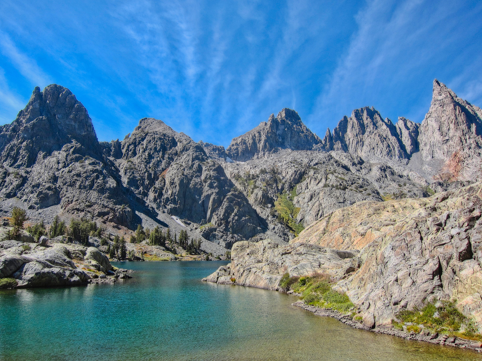
There’s a series of three lakes in the Ansel Adams Wilderness, just south of Yosemite National Park. They lie just below the sheer, jagged peaks of The Minarets. Minaret Lake, the southernmost of these, and the most easily accessible from the town of Mammoth Lakes, is one of my favorite places on earth. Pictures of Minaret Lake hang on my wall as reminders. The Minarets represents= my ideal of alpine beauty, and I would go once a month if I could. I haven’t been everywhere, but I’ve been some places(though not yet many in the Cascades) and Rampart lakes have now earned a place alongside them as somewhere I will always want to return to.
(distances are estimates based on the GPS in my watch)
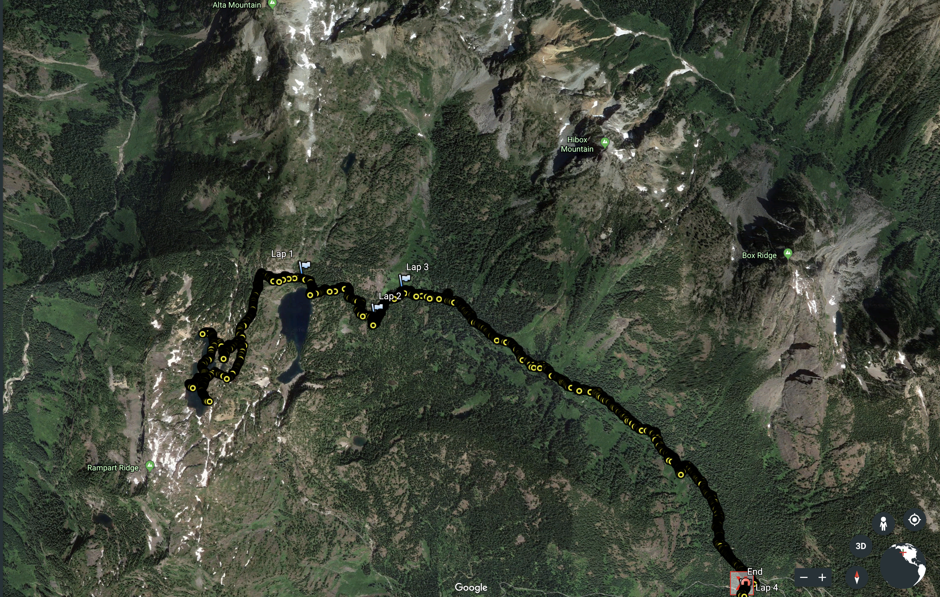
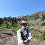
Following the hour and forty minute drive from Ballard, I walked out of the parking lot at 8am Sunday morning. Based on what I saw on the trail, most of these cars were likely from people who had spent Saturday night camping.
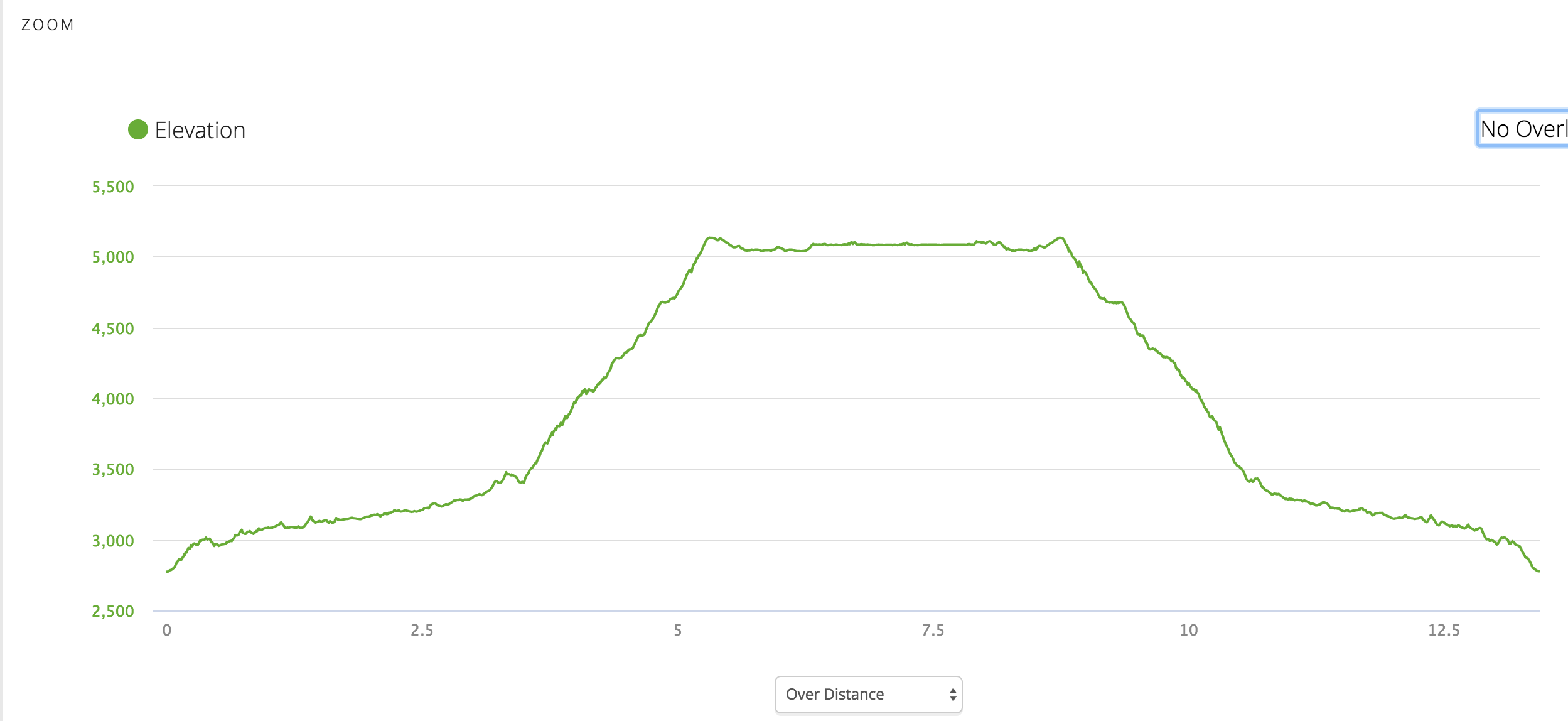
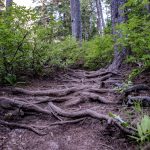
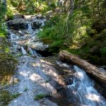
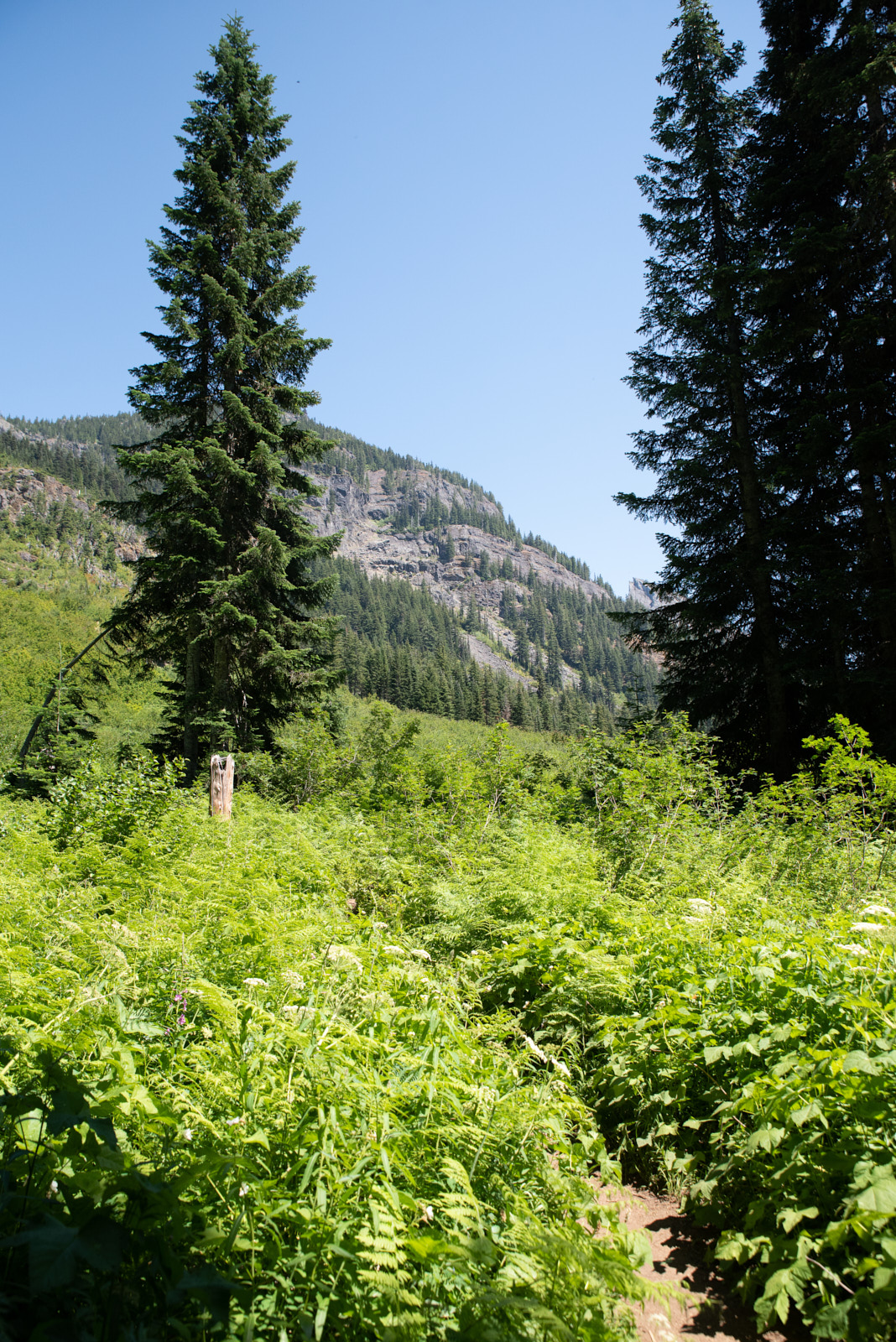
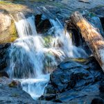
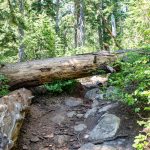
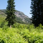
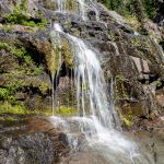
The trail ascends steadily but manageably for perhaps the first 3/4 of a mile before before mostly leveling out for the next 2.5 or so miles through the trees. It was in good condition, dry and maintained. Walking in forests is not my preferred type of walking, but the cascades of Canyon creek were cascading and in the still cool morning air, bugs were not an issue.
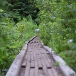
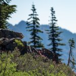
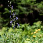
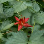
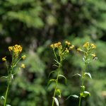
At several points, the trail narrowed to single track through waist-to-head-high vegetation(I’m new here, so not yet able to identify plants) that limited visibility.
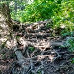
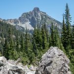
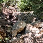
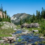
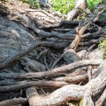
At mile around mile 3, the climb to Rachel Lake begins. And by climb, I mean that just short of literally. It is only a slight exaggeration to say that after a short series of short switchbacks, the trail goes nearly directly straight up with the occasional zig-zag. And it is rugged; rocky and tree-rooted. If you have knee, ankle or hip issues, there are plenty of opportunities to turn, twist or tweak a joint. 1200′ of elevation gain in no more than a mile and half, without the benefits of views along the way(but for one short exposure looking back into Box Creek Canyon and up at Hibox Mountain), but at least this is balanced by the cooling shade and several points where you can stop to watch the creek tumble down. Despite the challenges, it is eminently achievable, based on the body types and age ranges of those I saw descending that morning from a night in the mountains. I’ve been experimenting hiking sans trekking poles. They are inconvenient when you stop to take pictures. And in cases where the trail is such as this, I’ve found them to be an impediment, having to negotiate them be among the roots and rocks, making sure they are properly placed so they don’t get stuck and snap or bend when maneuvering. I’d have ended up just carrying them for sections here.
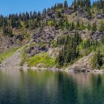
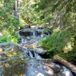
I did not spend much time at Rachel Lake, since it was not my objective and I was locked in to returning my Zip car at 5pm. But time spent walking it’s shores would surely have been well-spent. A short walk beyond the lake, the trail climbs steeply again for perhaps a third of a mile. This section is switched-backed and reasonably graded, but does have sections of loose gravelly rock where you need to watch your step. Here is where trekking poles might have been handy, especially on the sometimes slippery descent. The views opening up to the East also offer plenty of reason to stop and catch your breath.
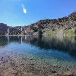
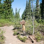
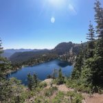
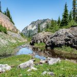
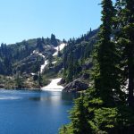
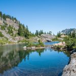
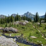
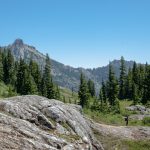
Atop the ridge, and to the lakes, where it becomes a choose your own adventure of trails. It took me about 3 hours to reach the first of the lakes from the parking lot, including time spent taking pictures. It was 11am, the day had warmed and there was standing water aplenty. So there were mosquitoes; lot of mosquitoes.
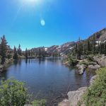
I wandered for about 90 minutes amongst the lakes and ponds and footpaths. I viewed the mosquitoes as encouragement to keep moving, as there was so much to see. I had to decide how much I wanted a picture before stopping to take one, i.e. how many mosquito bites was it worth? Every so often, the breeze would pick up, and I could stop and stand and enjoy the serenity of the lakes. I got one nearly 10 minute stretch at the head Rampart Lake where the breeze was enough that I could just sit and look unmolested.
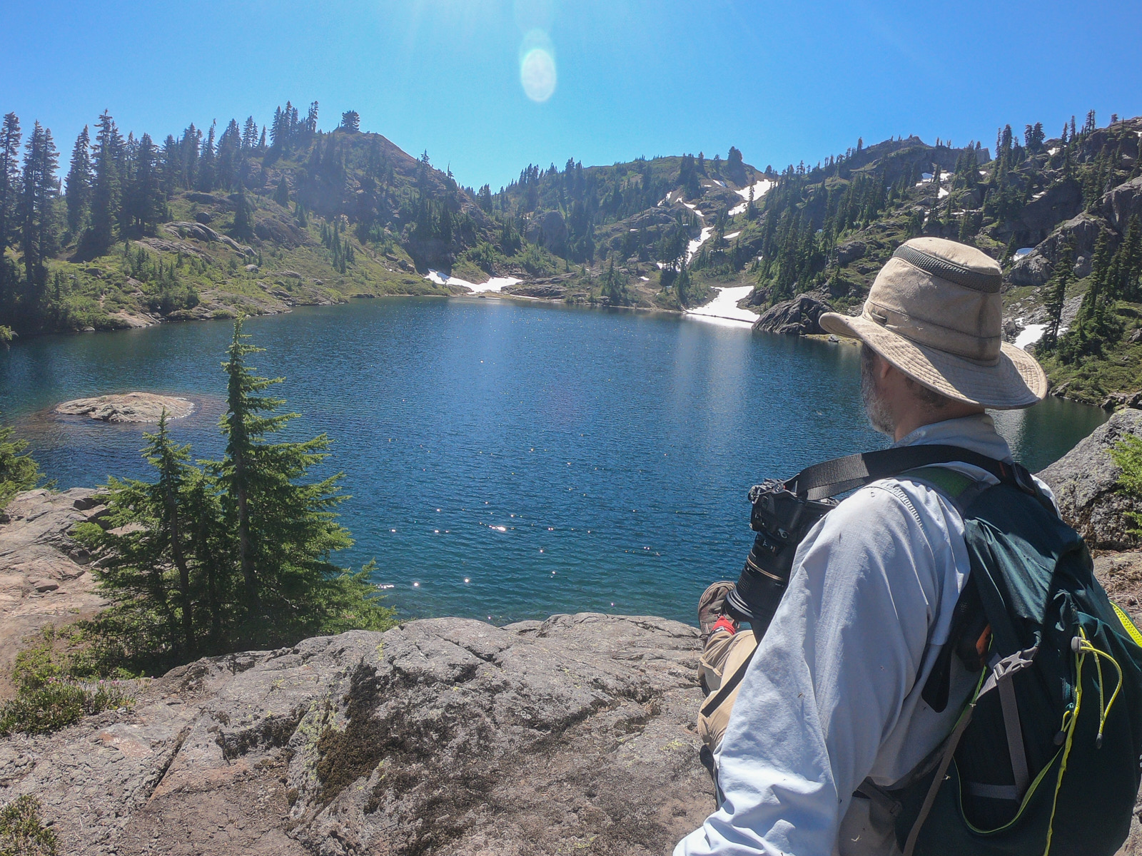
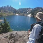
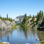
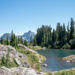
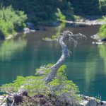

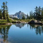
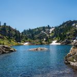
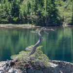
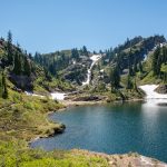
The breeze rippled the surface of the water, brief flashes of sun sparkled texture etched across the flat blue surface. Somewhere unseen, probably from beneath the crusts of dirty snow still clinging to the slopes, water audibly flowed. My instinct in these instances is to strain for meaning, to layer the foibles of my mind on to something that is just there. I could feel the sense memory forming, and so I briefly broke the spell to take out my GoPro, pressing record and hold it at my waist, allowing it to passively film what I would use as a touchpoint to return here. The sun, high in the sky, erased shadows and flattened out the slopes of Rampart Ridge descending to the water, hardly ideal conditions for taking pictures. But pictures weren’t my primary motivation for being here and I enjoyed the process of taking pictures probably more than looking at them afterwards anyways. The act of photography is mainly beneficial in teaching myself to better look and see, and poorly taken picture will trigger a memory just as easily as a flawless photo.
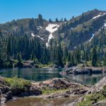
These breeze dropped and the mosquitoes again descended, so I moved on. I was mostly alone, but for a group of three or four I saw every so often at a distance. With all the places to meander, I think it would have to get quite busy up there for one to not be able to find some solitude.
I found the backdoor trail from Laura Lake along the eastern shore of the southernmost of the Rampart Lakes, and I plan on coming that way when I return. I did not see but a couple possible tent sites, and some of the smaller ponds that would be dry later in the season could be nice LNT campsites. I did not see any trees well spaced for hammocking, but there were some small, flat rocky areas that could probably handle a small free standing tent, or a person in a bivy sack, if you were willing to trust that it wasn’t going to rain.
On most hikes where I gain 2000′ of elevation outbound, I’d expect the return to be about 50% faster. But I knew that wouldn’t be the case today. I thought it might be even slower, since picking my steps carefully was even more essential on the way down way than on the way up, since not only would I have to worry about turning an ankle or knee, but also what gravity would do if I tripped and fell facing down rather than up. I ended up gaining about 30 minutes, but that was likely because I took fewer pictures. Maybe two miles from the parking lot, I heard movement up the slope, and stopped and looked just in time to see the sun catch a flash of gold-brown fur moving through the vegetation perhaps 50 yards away. But a brief glance was all I got. I passed a great many people heading up to Rachel Lake and beyond in the early afternoon. I would have liked to have left later in the day myself, to catch the light, but it was Sunday, and I didn’t want to be getting back late at night.
Better yet, rather than leaving later, I would’ve spent the day at the lakes watching the light change, mosquitoes be damned. But I was time bound to return the car.
It was a good day of hiking and a okay day for picture taking, the only disappointment of the day. What I saw was not what I brought back in images. There are a few of course. When you have a digital camera that you can use competently and the only limit on the number of pictures you can take is the size of your memory card, you are bound to bring home a few keepers. But I will have to spend some time looking at the less than satisfactory shots and figuring out what went wrong; whether it was technique – framing and focal length and f-stops etc – which I can fix; or just the conditions in which it was taken, which I cannot.
Google Earth