I was an hour up the trail when it occurred to me that I might have gone the wrong way; instead of being on my way up to and over Lamarck Col, I might be heading up to Piute Pass.
An hour of hiking should’ve been enough to come across Lower Lamarck Lake by now, and when I turned around and i didn’t see Grass Lake, which I should have based on my memory of coming down from Lamarck Col three years ago. I had just caught up to the two dayhiking Japanese men I had talked to when I first parked my car, when the older man had stopped to ask me about my camera, which had been sitting on top of the car. Now, they asked me how much further it was to the lake, and I said I didn’t know. I thought they were talking about Lower Lamarck. I had never gone this way, I told them, but had come down from Lamarck Col three years ago, and gotten lost several times,so it was hard to estimate how much farther the lake would be. I hiked on a little further, and thought to myself, perhaps when I told them my plan to go from North Lake, over Lamarck Col, down through McClure Meadow and Evolution Valley, up Piute Canyon to Hutchinson Meadow, over Piute Pass and back to North Lake, the reason they didn’t correct me and say, “No, this is the trail to Piute Pass,” and instead smiled and nodded wasn’t because I was on the right trail, but because they weren’t from here and didn’t really know where they were going either.
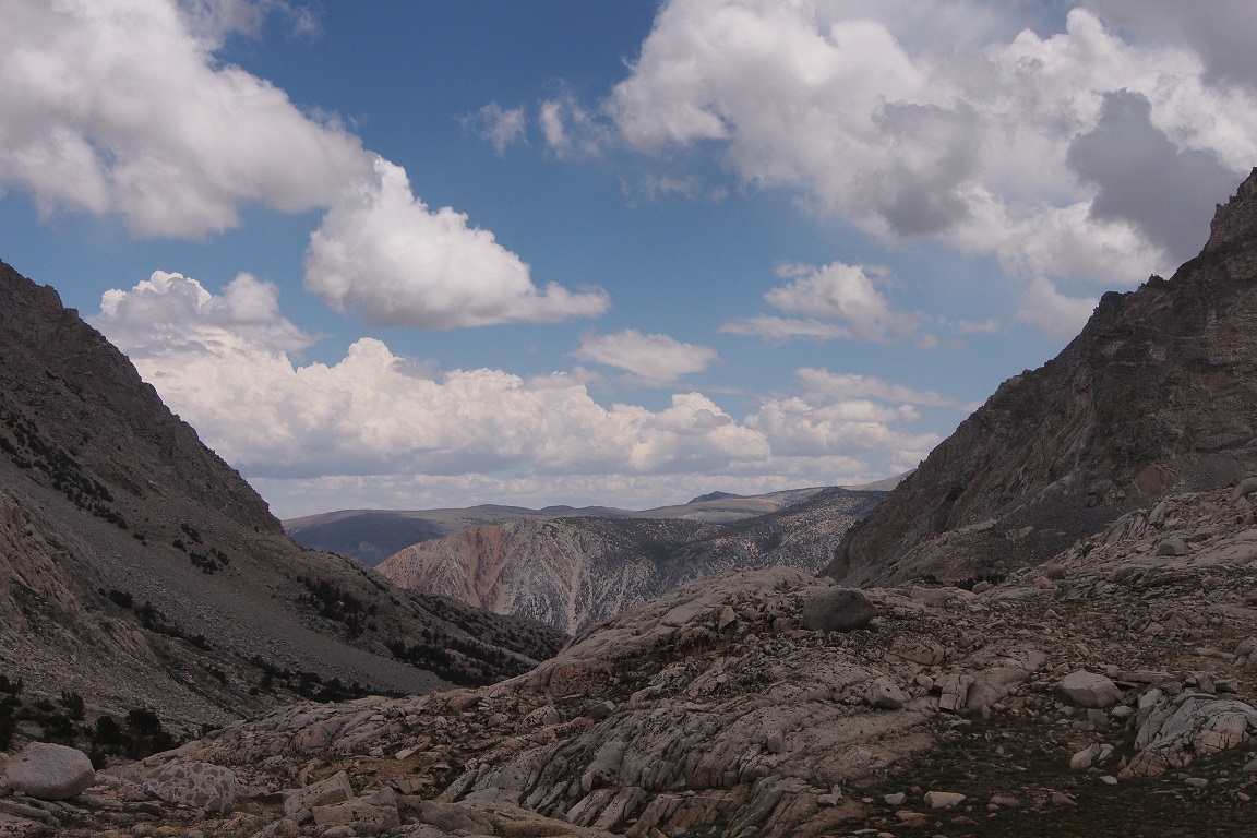
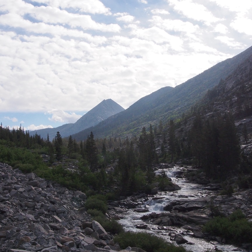
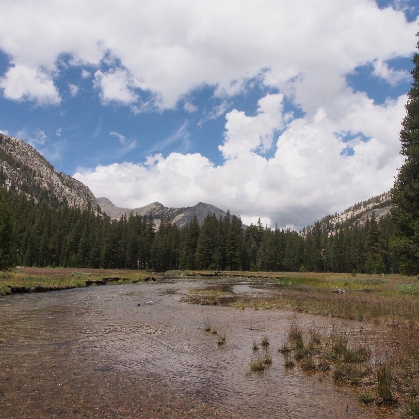
I walked on further and soon came to a lake and consulted my map. This was definitely not Lower Lamarck Lake, and instead was certainly Loch Leven.
I felt deflated. It was close to 11am. I could turn around, double time back to the start and head up the trail to Lamarck Col, or I could keep going in the wrong direction. Where had I gone wrong?
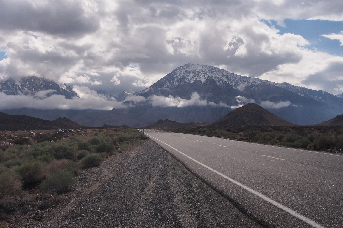
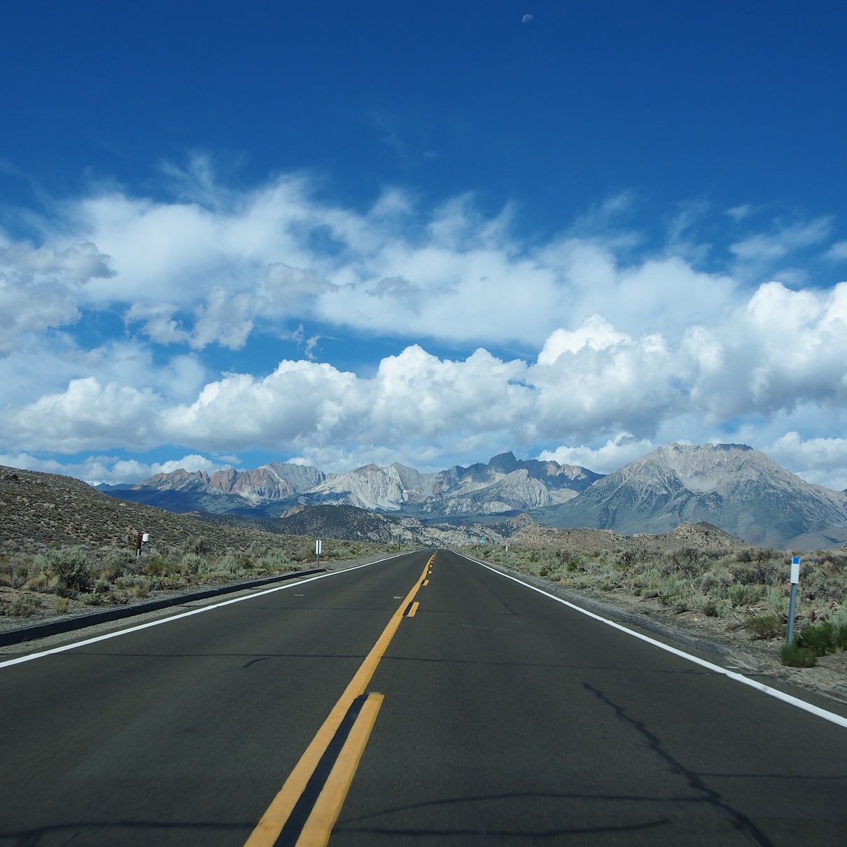
Driving up from Bishop on 168 I was full of positive feeling.
I’m not usually excited for these trips when it comes to actually doing them. In the lead up, sure, I’m full of giddy anticipation; but when the moment comes to drive to the trailhead and walk away from the car, I’m a bundle of anxieties and already counting the time till I can be back. I think it’s because I go alone, and there’s no one to talk to for four days but myself, and that is not a prospect I relish. I’m not the best company. There is also the fear of bears, which inhabited my nightmares long before I went out into the mountains to sleep among them; and the fear of the dark and all the strange noises. I know some people think of the wilderness as peaceful and quiet, but it’s not. It’s as full of noise as Manhattan; in fact, to my brain, it’s probably noisier. All the sounds of the city, so familiar, my brain just identifies and filters out and I’m enveloped in my own kind of solitude. Out in the mountains, everything is unfamiliar. I hear every sound, real and/or imagined, and my nerves are on edge as my lizard brain tries to identify whether or not they are a threat.
But that morning, as I sat on the porch of the America’s Best Value Inn in Bishop and drank my coffee and looked out at the mountains I was about to visit, I felt none of that.
Which was surprising, because I was going to go up Lamarck Col to erase the bad thoughts of three years ago, when I had done the other half of the North Lake to South Lake Evolution “Loop”, beginning at South Lake. My first solo attempt at cross-country travel, started out fine as I struck out across Dusy Basin on the first day, meandering off-trail before navigating my way back to the trail and setting up at Lake 10700′. It ended less well on day four, as I got lost three times going over Lamarck Col from Darwin Bench; first by mis-identifying and undershooting the Col; then by heading down the wrong use trail before realizing my mistake; then ending up on another use trail that took me to Grass Lake rather than back to the trailhead. I found my way, but ended the trip full of self-doubt, wracked nerves and a broken trekking pole from a pretty bad fall.
I drove up North Lake Road, approaching the terminus at the campsite, where I assumed there would be overnight parking. I overtook a woman who was hiking along the road. She turned, looked at me then moved into the middle of the road and kept on walking, more slowly than before, almost shuffling. What was she doing? A moment later, she moved aside, just enough for me to pass, and as I did, very slowly, she turned to me and yelled “Slow down!” I was taken aback; I hadn’t been going more than 10mph along the potholed road as I came up behind her.
Feeling defensive but also wondering if I had been going too fast, I circled the parking lot and didn’t find any parking, just campsites, so I went back down the road to where I had seen cars parked and figured this must be it. I parked the car and organized my gear. . I knew the rules even before the Ranger giving me my permit the day before had reminded me that there were to be no smell-ables left in the car overnight, to avoid bear break-ins, so I packed my spare food, deodorant, toothpaste and such in a duffle bag. Since there were no bear boxes here, there must be some at the trailhead.
I started down the road, and not 10 yards along saw the sign, hidden behind an overgrown bush, pointing to a right turn into a parking lot for the trailhead. I went back and moved the car to the lot. I walked the 10 minutes down the road to the campground. The only bear boxes there were for the campsites. I was perplexed. I walked back to the car and debated what to do. On one hand, if there were no bear boxes, car break-ins must not be a big issue here, despite the ranger’s warning, and the presence of boxes at the campground, and also at South Lake trailhead, perhaps 10-12 miles away as the crow flies. On the other hand, I didn’t want to return to my rental car to find the back window smashed in and the inside torn to shreds by a black bear. I ended up throwing out my half back of cheetos, some trailmix, the tube of toothpaste and stick of deodorant.
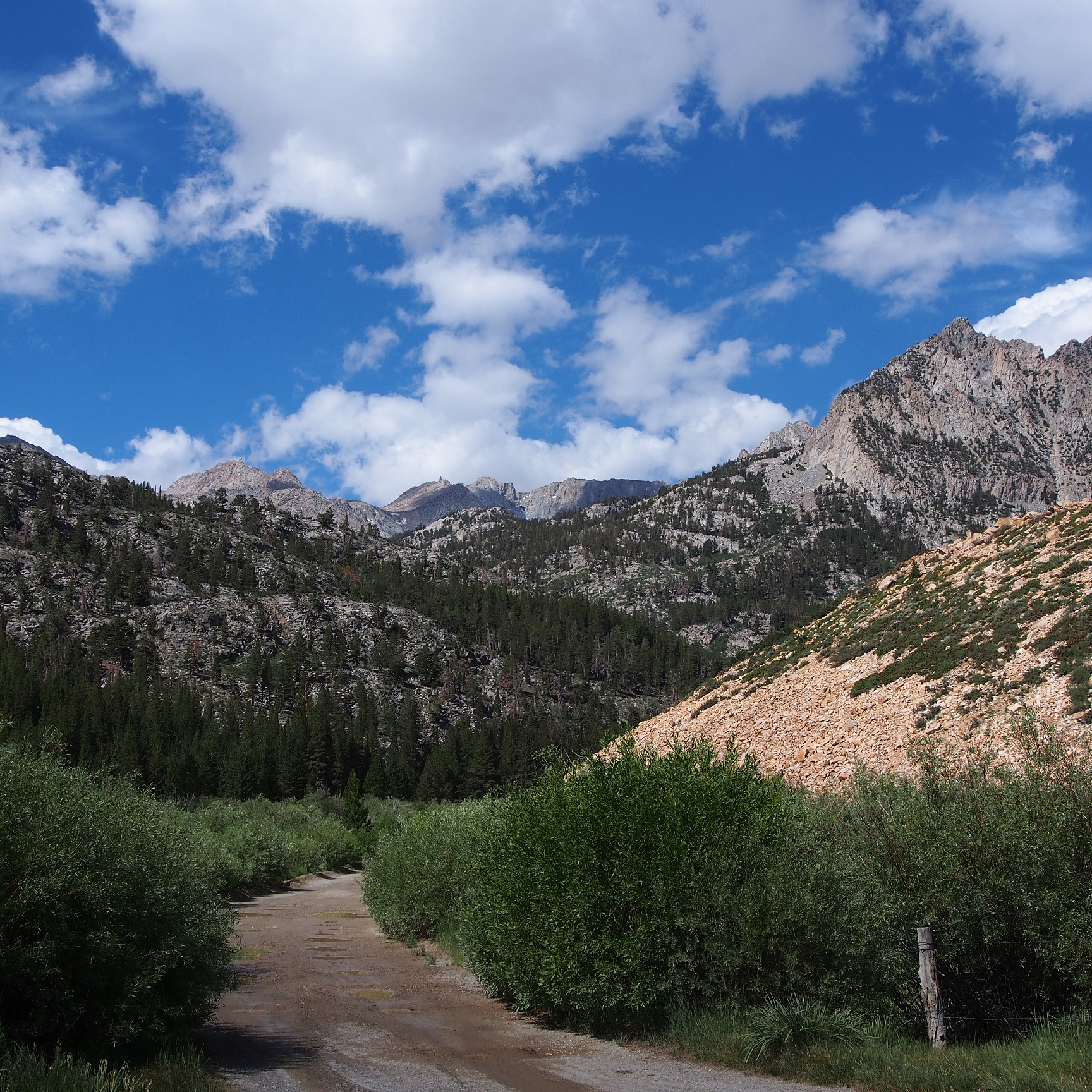
I hiked back to the trailhead. I’d now walked close to a mile before even starting my hike, and wasted 50 minutes since I arrived. I walked, and tried to calm the negative voices in my head. I told myself to pay attention, to make sure not to wander off onto a use trail, getting lost, as I had last time. Tonight, I’d be on Darwin Bench, looking out over Evolution Lake and to the distant peaks lit with alpenglow, and all of this would be forgotten, the satisfaction and having overwritten my mistakes from three years ago filling me with a warm glow. Not far from the trailhead, near a walk-in campsite, I came across a group of people, a tape measure and some line lay across the trail. They excused the mess as I passed and went on my way.
Now, as I stopped and looked at the map I realized that there had probably been a trail junction right where they were standing, and I missed it, distracted by the group, and the voices in my head.
Clouds were beginning to form in the previously blue sky, and I anticipated an afternoon thunder/hail storm similar to what I had encountered the day before on my day hike over Bishop Pass to Dusy Basin. Psychologically, I didn’t think I could handle going back and starting over. I didn’t think it would be a big deal to just do my hike in reverse, other than violating my permit. I had mostly chosen to start with Lamarck Col because I didn’t feel like making the steep climb up from Lake 4 in Darwin Canyon again, even i that really would really have been the way to go if I wanted a complete do-over. i suppose I like to hedge my bets.
The voices started in again, suggesting I go back, take one of the empty campsites and the trailhead, spend the night there, then hike over Lamarck Col the next day, spend a night, or two on Darwin Bench, and then go back to a hotel. Heck, once I got a campground, I could drive the 45 minutes back to Bishop and eat McDonalds for dinner and return to the campsite just to sleep. Or just spend the night at a hotel in Bishop. Make this a day hike. I struggled to ignore this part of me, the part that’s been with me all my life, always trying to figure a way out of things that made me uncomfortable.
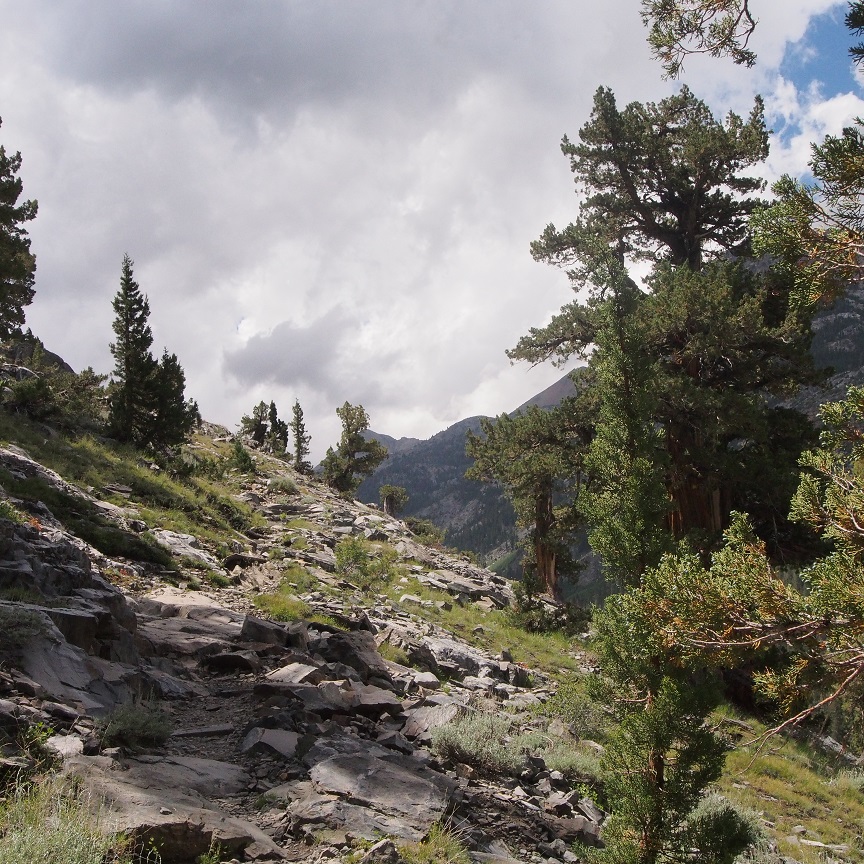
I walked along the shore of Loch Leven, purging these thoughts into my digital recorder, overtaking day hikers and backpackers along the way, who may or may not have been wondering at the odd man talking to himself.
I turned back and took pictures of Piute Lake and ascended to the pass, alternately laughing at myself and cursing the way I so often seemed to get things wrong in the wilderness. There is a gap, usually, between the way one see’s oneself, and the way one actually is; I debated whether I really was an outdoor person, or just saw myself that way, aspirationally, even though I wasn’t really cut out to do it, I was just forcing myself to be a way I thought I should be and making myself miserable in the process.
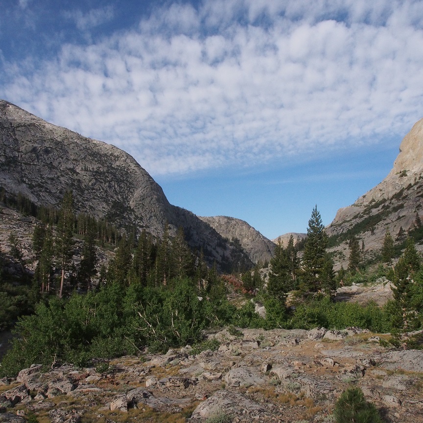
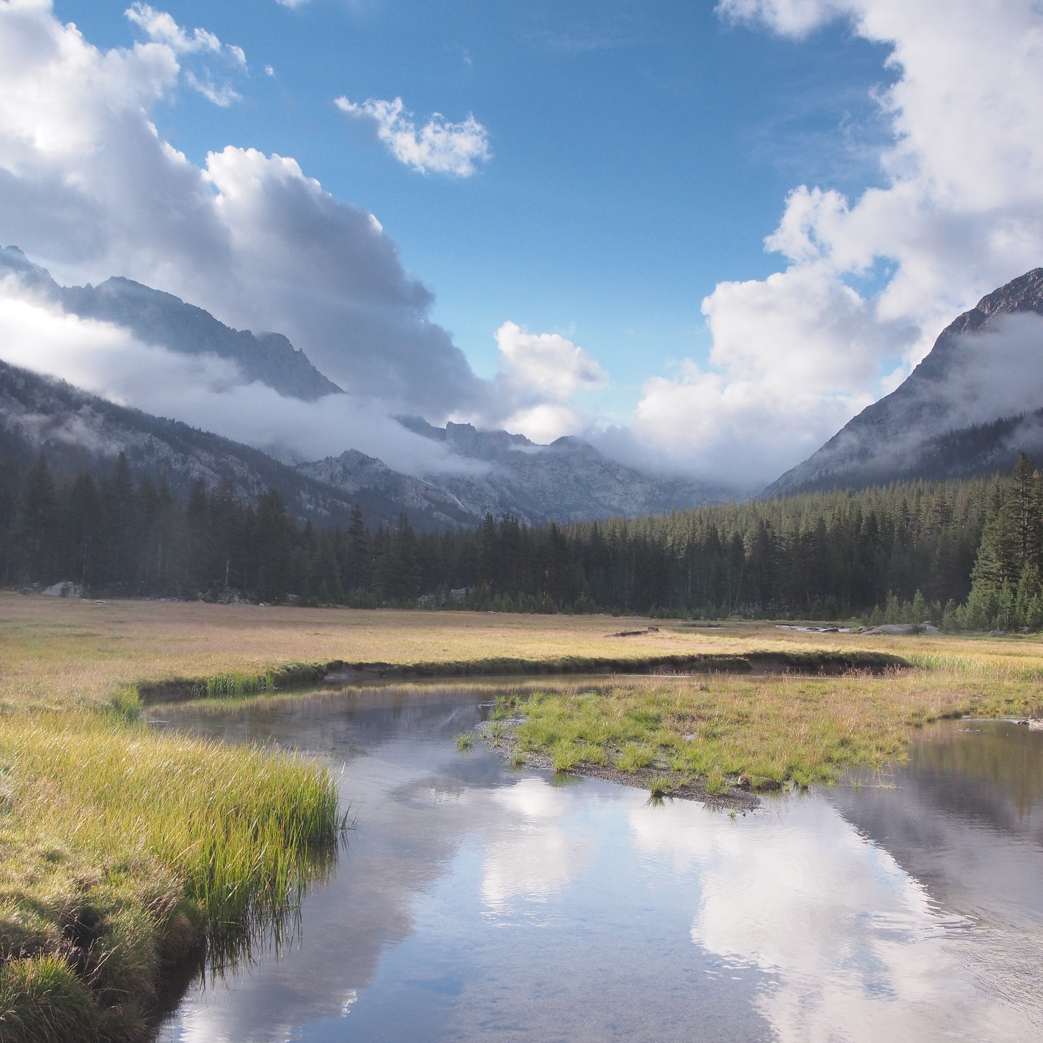
Piute Pass was unexpectedly beautiful. Why it was unexpected I can’t say, but it was, and it erased the frustration at having taken the wrong path.

By now it was 12:30 and the clouds cast moving shadows over Humphrey’s Basin. A co-ed group of college-age kids were at the pass having lunch and a day hiking man warned them to keep their packs close by; there was a thieving marmot about. I took in the view and debated where to spend the first night of my revised itinerary. I would prefer to hike on to Hutchinson Meadow, rather than detour and stop early at Desolation Lake. I get bored at camp, and prefer to hike long days, watching the view change and re-assemble itself at 3mph, to sitting in one place and studying a static scene. It also evened out the mileage if my goal was to spend the second night in McClure Meadow, near the ranger station, before spending the third night on Darwin Bench.
I overtook another group as the rain and hail began, a family and their kids’ friends, teenagers again, spread out over maybe a quarter mile of the trail. We chatted as we stopped to put on rain gear. They were headed for cross-country, for French Canyon. Shortly, they turned off the trail, with the navigators having to yell those who bombed ahead, not knowing the way (teenage boys, not surprisingly) to turn around, they’d missed the turn-off. And yell they did. And yell. And yell.
Then I was alone, crossing the basin.
The hail tapered off. I checked my watch and kept my eyes open for campsites. I passed the spot on the map where the use trail that led to Desolation Lake should be, missing the junction, whether subconciously or by intent, I can’t say.
Hutchinson Meadow was about 12 miles from the trailhead. I wanted to believe that would be about 4 hours of walking. But I had discovered in the last year or two, as I aged (I turned 40 in December) my pace had slowed down. I didn’t feel slower; I was working just as hard, but where I used to make 3-3.5mph, now I was more like 2.5-3mph. It gave me empathy for professional athletes, who can’t quite catch up to that fastball anymore, whose first step abandons them as they drive to the basket or try to pivot and cut into that split second gap opened up by their linemen.
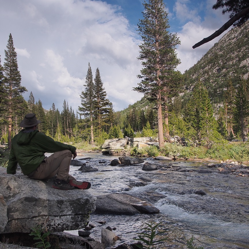
When I dropped from the open basin onto the forested slopes near Piute Creek, I saw some sites near a cascade. A lone man was there, watching the water crash over granite. There were other sites, but camping there would probably have violated the wilderness camping rule regarding how close you are allowed to camp to other people. I don’t mind other people out in the wilderness; I’ve spent 18 years living in cities, in apartments, where we are stacked on top of each other. My idea of solitude is elastic.
But other people have other ideas. I had found that out on Darwin Bench three years ago, when, after looking for a suitable place to set up my tent, far enough from the group of three men who were encamped atop the granite hump just above the first tarn as you come up onto the bench to be respectful but within walking distance of the overlook of Evolution Lake and the peaks beyond. I was out of site, behind some trees,
I estimated 75 yards, and anyways, they had to stand up, walk to the edge of the dome to see me. Which two of them did, as I boiled water for dinner. The third, a friendly red-faced guy, came down to say “Hi”, asked where I’d come from and where I was going and chatted for a bit before telling me he had no problem with me camping here, but his friends did, so I should keep to myself. I had planned on that anyways. I figure everyone is out there for their own reasons, on their own hike, and wanted to be left alone unless made otherwise clear. These three were on their annual hike. They had come over Alpine Col that morning and were going out over Lamarck Col tomorrow. The group was supposed to be four, but the fourth friend had died of a heart attack three weeks prior, and the trip had turned into a memorial for him, a memorial I was now intruding on. As with the incident with the woman on the road that had happened just this morning, the encounter left me feeling both apologetic, and defensive and wronged. Who were these guys to think they owned the wilderness and had the right to tell other people where to camp?
Then it had been late in the day and the light was failing; now it was only 3:30pm; plenty of time to find a more solitary camp, so I went on, hoping to come soon to Hutchinson Meadow, where I recalled from Backpacking California there should be some decent sites, knowing if nothing turned up, I could come back here
Twenty-five minutes later I came to the junction with Pine Creek trail.
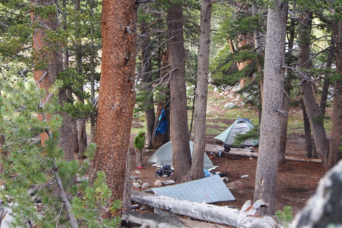
There were many excellent sites in the open meadow, among the trees near Piute Creek. I walked on for a bit, but after 10 minutes realized I didn’t want to make another five miles to the bridge over Piute Creek, where the trail met the John Muir Trail. Any campsites there were likely to be crowded, and campsites in Piute canyon were unlikely, so I turned back.
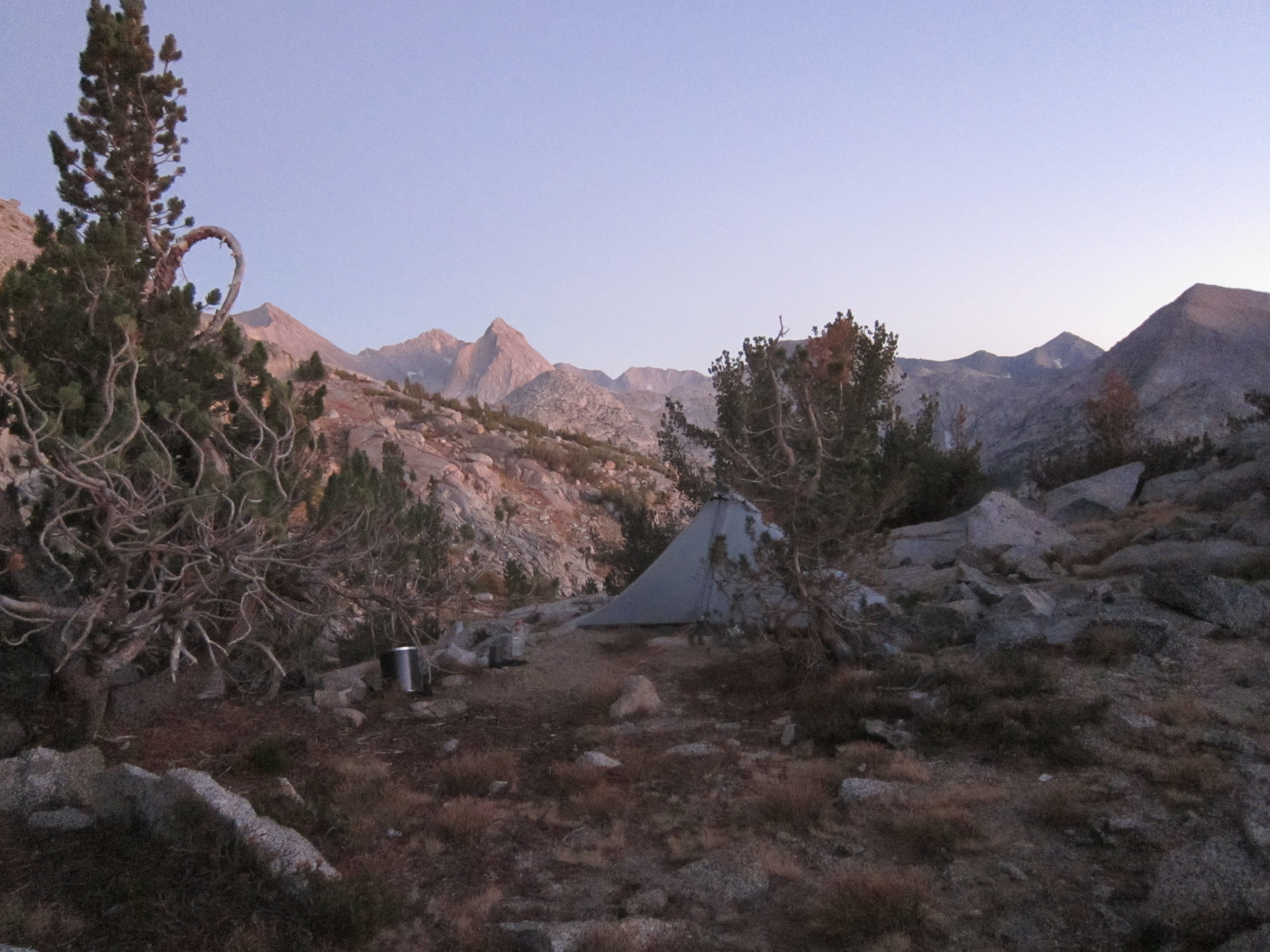
I set up my tarp, a pretty good pitch on the first attempt considering how infrequently I get to use it.
I ate my lunch, a buffalo chicken wrap I bought at 8am from Vons, my first meal since two McDonalds breakfast burritos, a hash brown and coffee at 830am in Bishop, besides my Perpetuem. I’m supposed to drink 2 scoops every two hours, about six miles of hiking, mixed in my 20oz Gatorade bottle, but I hadn’t been good about it today. I use the Perpetuem becauseI don’t like to stop and eat and I have little appetite when I’m hiking at altitude. In the past, trail mix and chocolate bars have gone uneaten and I’ve walked, literally, right up to the edge of bonking, so I drink my calories in water that tastes like watery chocolate milk but gets 135 calories an hour into my system. Today I’d only managed two bottles, or 540 calories over 12 miles, and I worried about feeling the effects while I slept as my muscles cannibalized themselves.
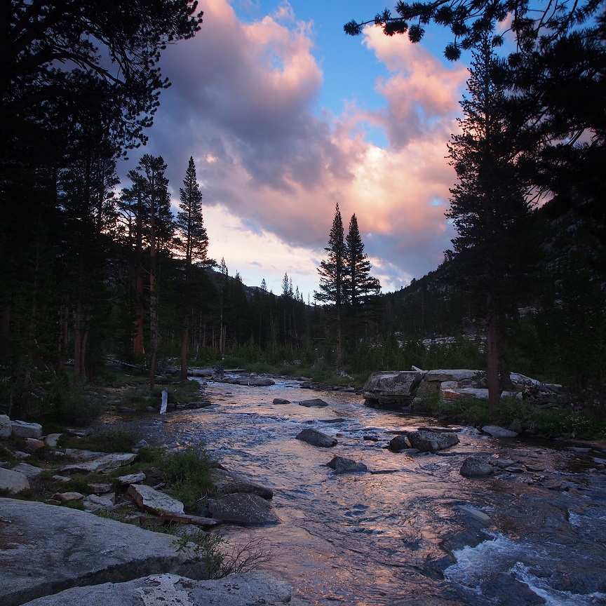
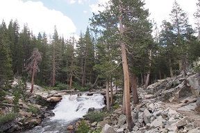
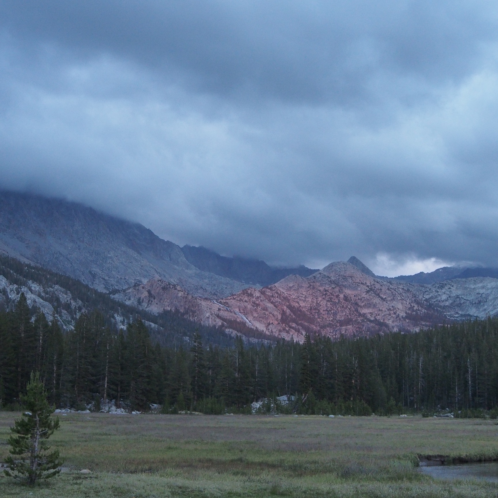
After dinner, I purified more water and watched Piute Creek.
I found this:
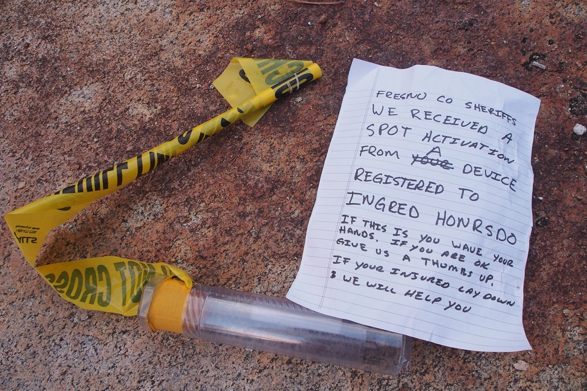
I had unravelled it from the cracked plastic tube that must have been dropped from a helicopter. I rolled it back up and replaced it, hoping that whoever it was had gotten out safely. I carried my own Spot device, for the peace of mind of my family more than myself, and it heartened me to know it worked, even as if reminded me of the possibility of my own mishap.
I ate another wrap for dinner around 8pm. I wasn’t really hungry, but as my calorie intake so far that day was only around 2000, and my Garmin fitness tracker estimating my calories burned to be over 4000, I knew I had to eat more.
I sat sipping my nightly dram of Johnnie Walker Red and contemplated being out here alone, watching the creek as darkness descended and thought about what I always think about; how this river and all these things just happen whether I am there to witness or not. Living in cities, where everything that happens seems to happen because humans cause it, it’s easy to forget that the world is indifferent to my existence. I would’ve thought that living in Manhattan would have taught me that, but sometimes you have to walk away from civilization to realize how little you are.
I played with my camera and the graduated filters I was still learning to use.
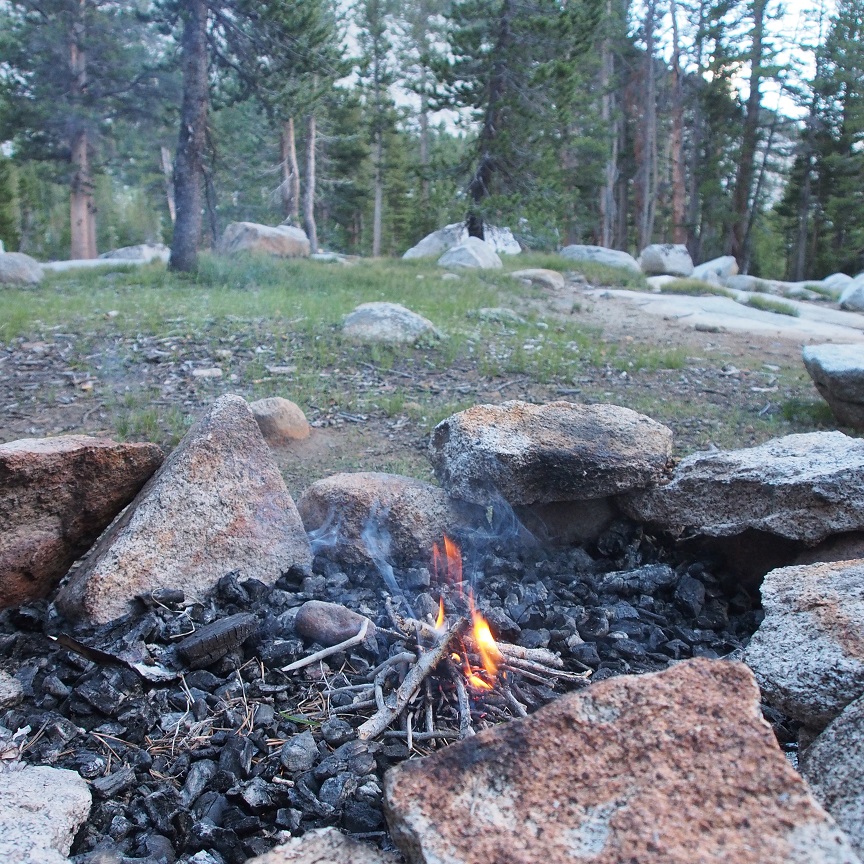
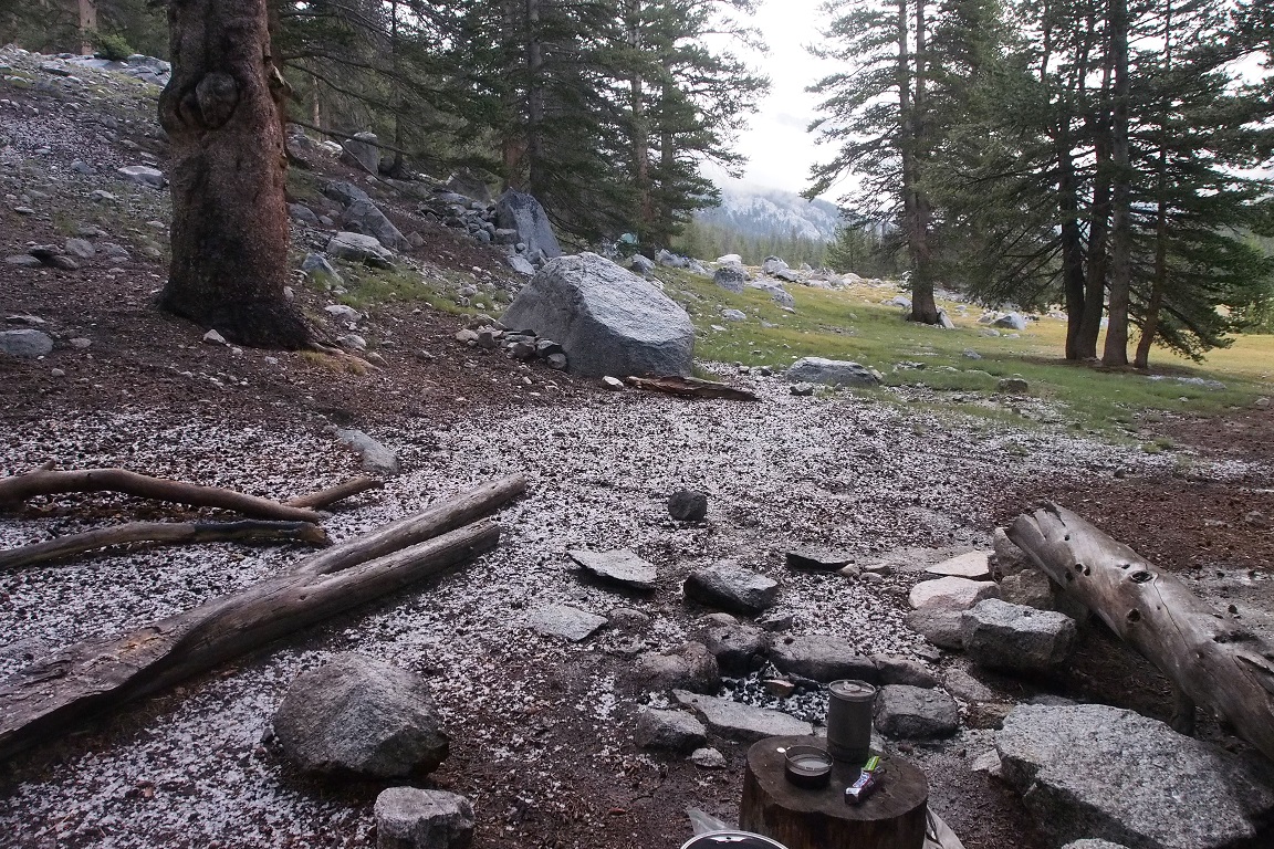
I made a small fire in the fire pit left by someone before me, a human imprint on the wilderness, but extinguished it when I remembered that the ranger had told me there was a fire ban on because of the drought. I rarely, almost never, make fires in the wilderness. Usually, I’m above 10000′ where fires banned regardless of conditions, not so much because of the fire danger, but because, as a ranger had explained to me, there is a dearth of biomass that high, near the treeline, and the little that was there needed to be preserved, to degrade and be returned into soil to start the cycle of life and death again. But this time, after gathering plentiful downed branches, I had, and I was proud of myself, using a skill I wasn’t sure I had, so it was disappointing to extinguish it, but I was already breaking the rules by violating my permit, I didn’t need to go all backcountry outlaw at once.
Usually, I’d stay awake and lie out and watch the stars come out, but it was early July, and the sky remained a deep cobalt blue until after 9pm, and I was exhausted, physically and mentally, so I crawled under my tarp and went to sleep.
Day 2
I was out of camp at 7:30am. I’m not the earliest riser and I enjoy my morning coffee and Snicker Bar. My plan for the day was to make it to McClure Meadow, near the ranger station, and if it was still early enough, and I felt up to it, continue on to Darwin Bench. I would see where it was at 12:30, five hours to cover what I estimated to be 15-16 miles.
It was up and down thru Piute Canyon to the junction with the JMT.
I arrived around 9:30am. 2 hours to cover 5.2 miles. Not bad but not great. My tailbone was sore from where I fell, stepping back without looking to better frame a picture, lucky that the rock I landed up was flat and smooth. There were quite a few campers; I would’ve likely had a time of it finding space if I’d gone on yesterday and showed up at 5:30pm. Most of them seemed to be just getting started with their respective days. I stopped and filled up my water and mixed more Perpetuem.
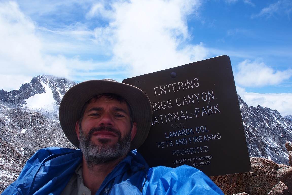
I entered Kings Canyon National Park.
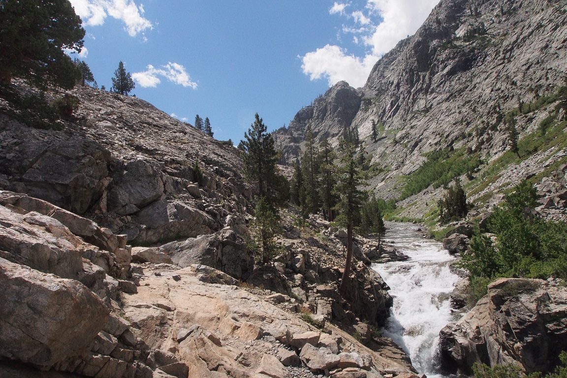
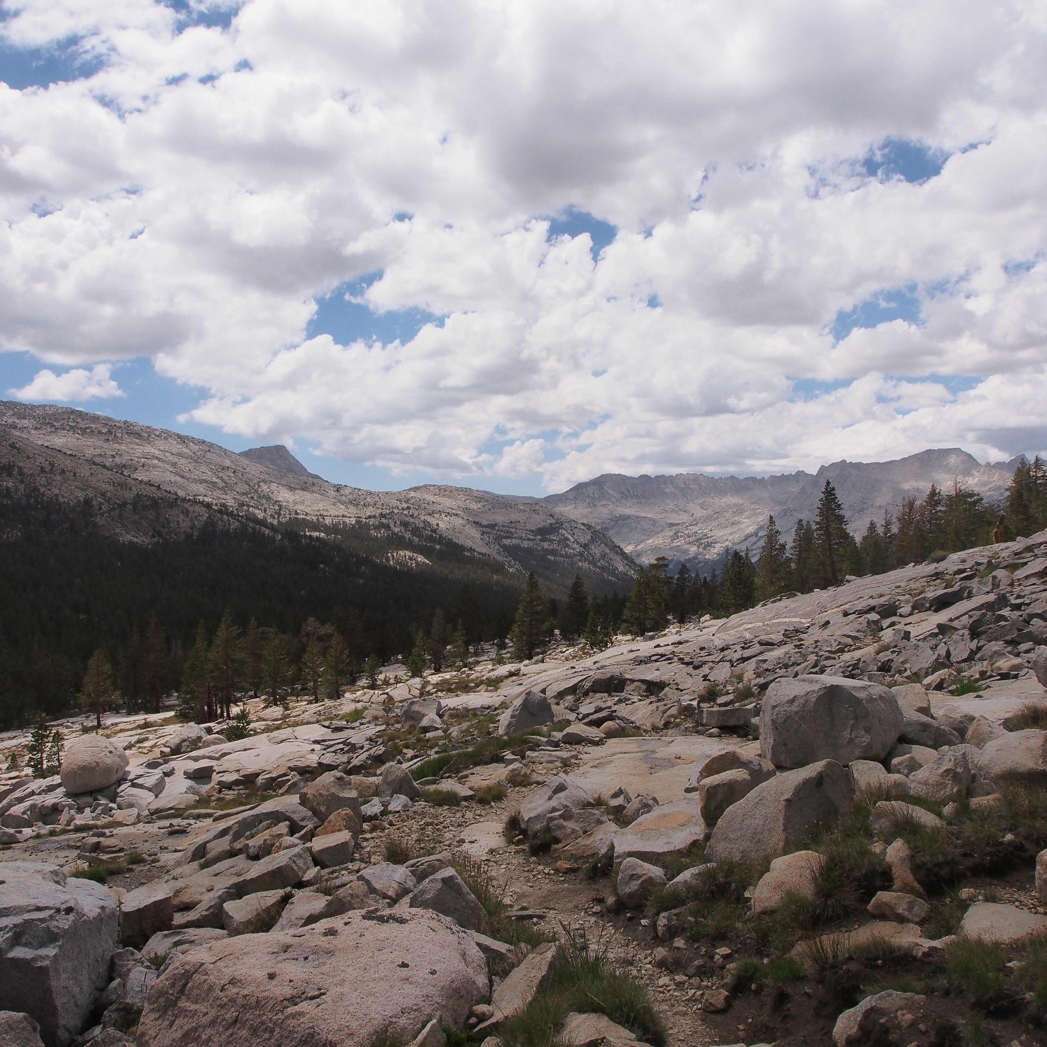
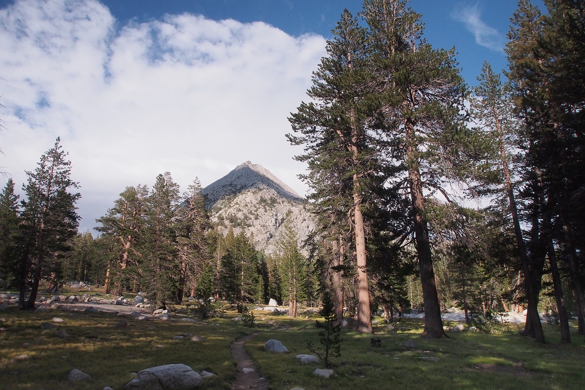
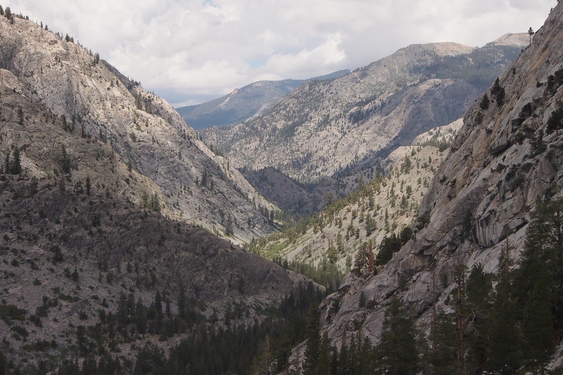
They day grew hotter and the trail along the south fork of the San Joaquin River was rocky and uneven, but I made decent time to Goddard Canyon, where I ascended the steep switchbacks along Evolution Creek to Evolution Valley.
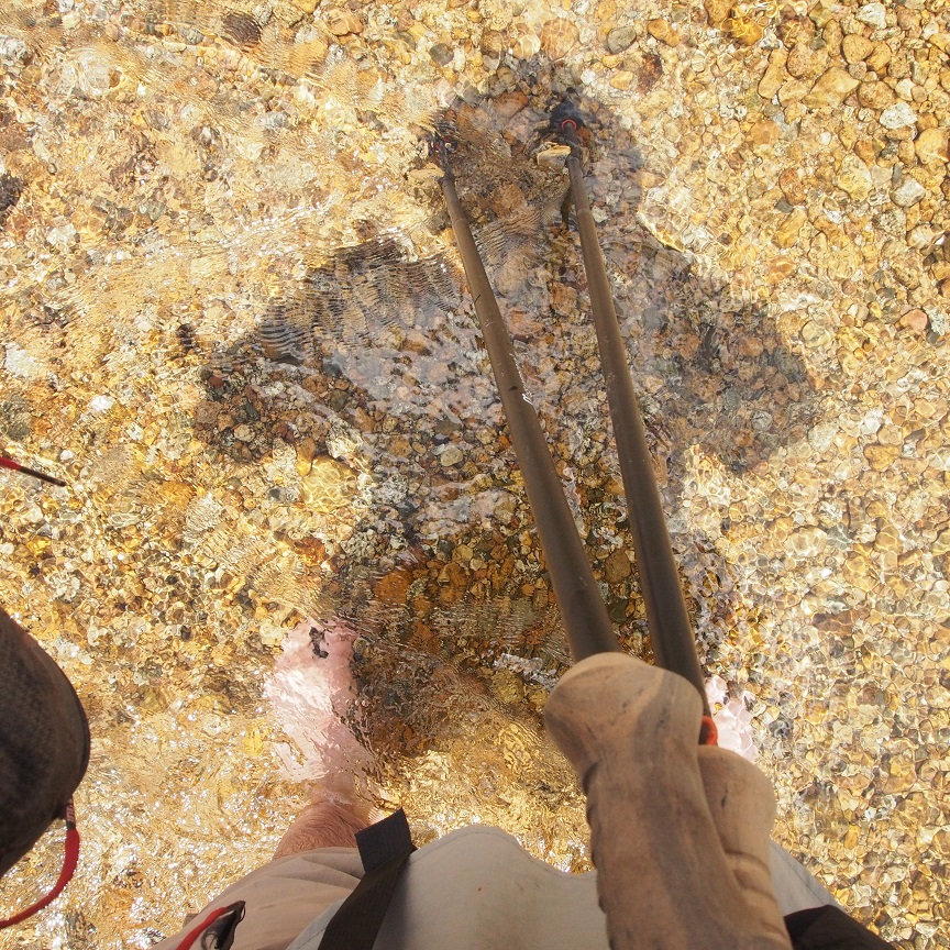
I took the use trail and crossed Evolution Creak at Evolution Meadow.
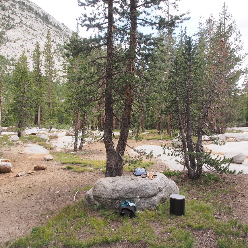
I walked barefoot for awhile as my feet dried. I started looking for campsites. I didn’t think the ranger station would be much farther but if I saw something good before then, I would stop. It was around 12:30pm, and I reached the ranger station around 1pm. It was clearly a popular stopping point based on all the impacted sites, but it was almost empty for now. I took a site down away from the trail and far from the only other occupied sights.
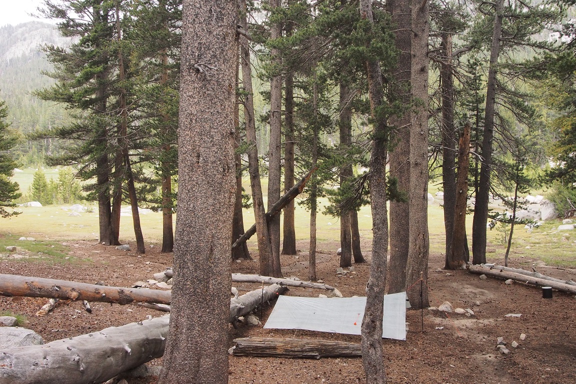
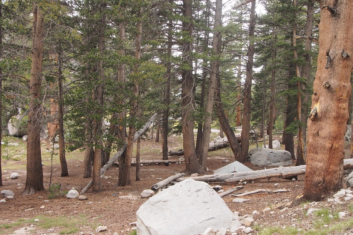
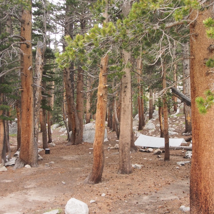
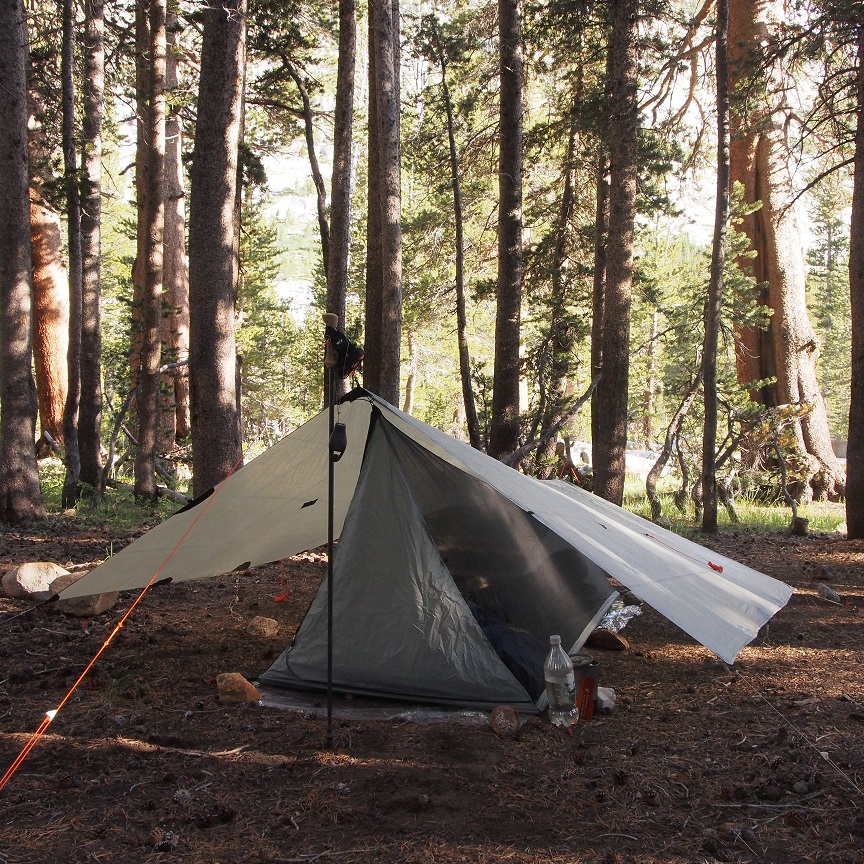
Rain was threatening again so I set up my tarp. The site was a bit tricky, the ground not quite level, and I had to spend some time studying to find a spot that didn’t look like a place where water would flow through or puddle. I didn’t get nearly as good a pitch this time, but it was good enough. I sat down by the creek to eat. It was only 1:45pm and I could easily push on to Darwin Bench. But I wanted to stay in the meadow, and I wanted to arrive on the bench early in the day to best assure myself a choice of campsites. It started to rain, so I crawled under my tarp and closed my eyes for a bit, listening to the drops patter on the tarp. Along the perimeter, where the rain dripped off, puddles were starting to form and a couple small rivulets were carving paths toward me through the loose soil . I took my trowel and crawled around making a shallow trench backed by a berm.
I remembered another incident that had happened here on that same trip three years ago. I had hiked down to McClure Meadow from Evolution Lake early in the morning, because I didn’t see the point in getting to Darwin Bench at 8am and spending the whole day there. I reached the ranger station and stopped to study my map and refill my water. While I was doing so, a couple passed on the trail going the same direction I would be. I waited a bit longer to give them a head start. I started to overtake them, and when I was about 50 yards behind them, the husband turned around and looked back in my direction. I was glad, because I assumed then they would know someone was behind them and wouldn’t be surprised when they were overtaken. A few minutes later, at a wide point the trail, I approached to 10 feet behind the man and announced “Passing on your left.” The man jumped out of his skin. He MF’d me, yelled at me for sneaking up behind him, and cursed me some more as I passed, apologizing profusely. I guess he hadn’t seen me. I passed his wife, who was stopped and staring at me as well, apologizing again to her, and went double-time on my way to put some distance between myself and them.
That, the offense I caused the three campers on Darwin Bench; yesterday morning with the woman on the road; getting on the wrong trail again; those things don’t happen to me anywhere else. I don’t think of myself as an incompetent or inconsiderate person, but I was starting to wonder. I’m still not sure if I was in the wrong or if it was just bad luck. Coupled with getting lost going over Lamarck Col and taking the wrong trail this time; I just didn’t know what to make of my relationship with this place.
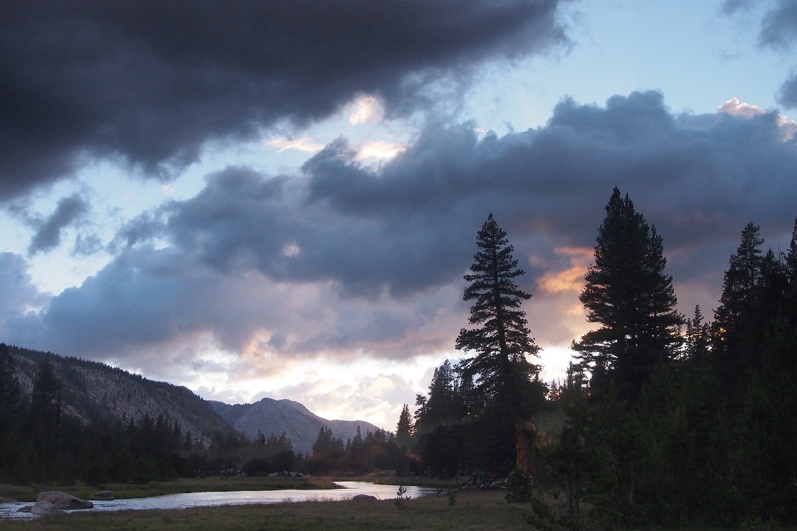
The rain stopped, though the skies didn’t clear.
The camp started to fill up with JMT hikers, who all seemed to know each other from the trail. Most of them seemed to be headed Northbound. I knew I would get neighbors, I just didn’t realize how many and how close. I ended up with three tents within twenty yards of mine, including an retired age couple that set up not much more than 20 feet away and proceeded to turn the surrounding trees into coat wracks for their jackets and gear, spreading all their stuff generally around. I only occupied the space that my 8.5’x8.5’ tarp took up. Outside of my bear canister, everything I had was stashed under there, and these people were treating what I considered to be my bare minimum of buffer space like their living room. Now, to get the water, I had to loop around their site or walk right through it. I understood, the campsite was crowded, and this may have been my penance for offending the three friends three years ago. I was more annoyed than angered, but I would’ve appreciated a cursory “Hi, sorry we’re so close, the campsite’s really packed today.”
I was going to walk to the creek to get my water for the night, but I stopped short when I saw a man bathing naked. I decided to give him privacy, though I guessed he didn’t care.
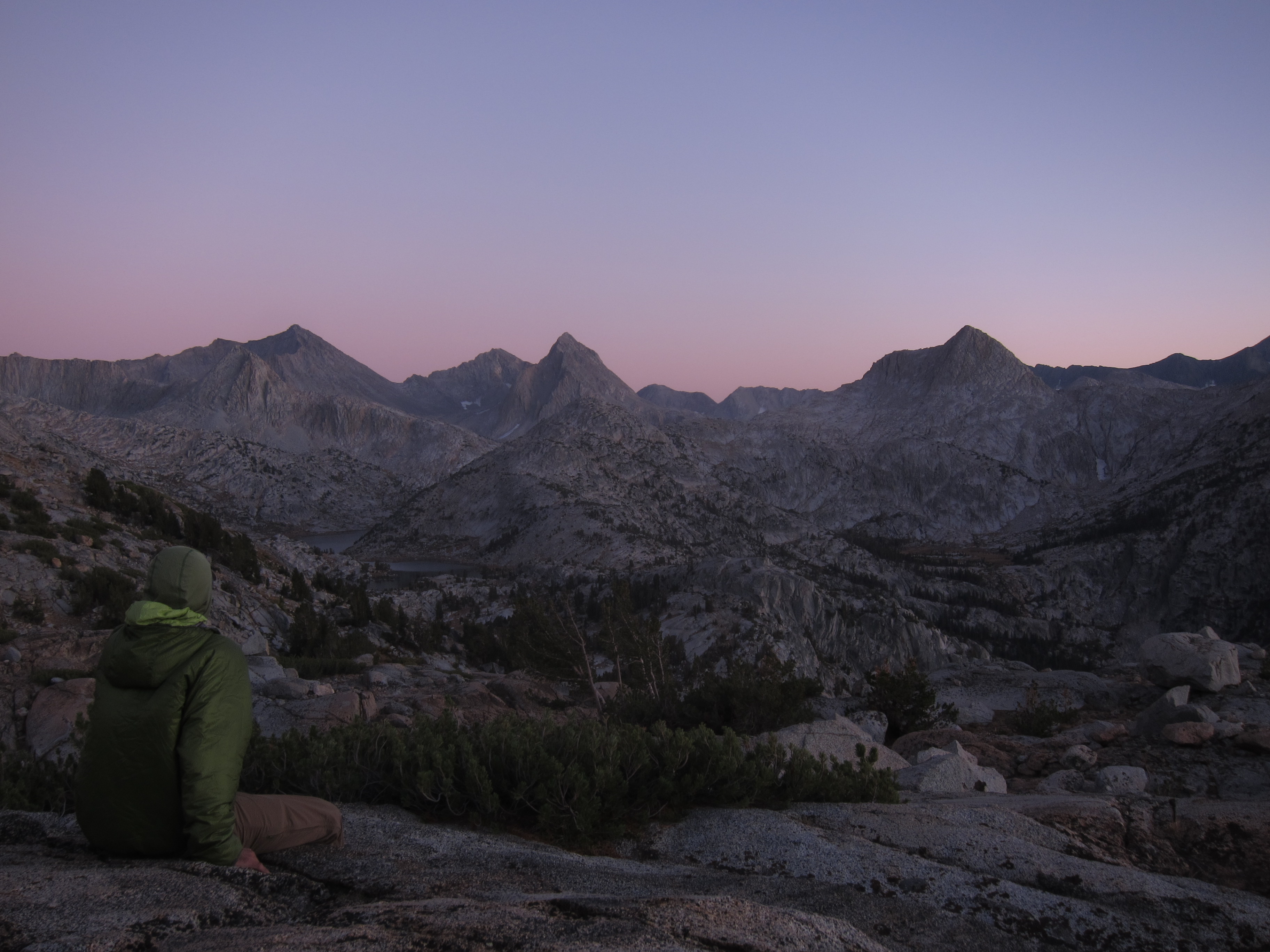
I stayed away from my campsite, walking the meadow, drinking my dram of scotch, watching the sun set and the alpenglow light the peaks to the east. The sounds of camp, people catching up, telling their stories from the trail; from no one to a small village. I could have been sitting in Central Park. I sat and reassessed my feelings about solitude in the wilderness.
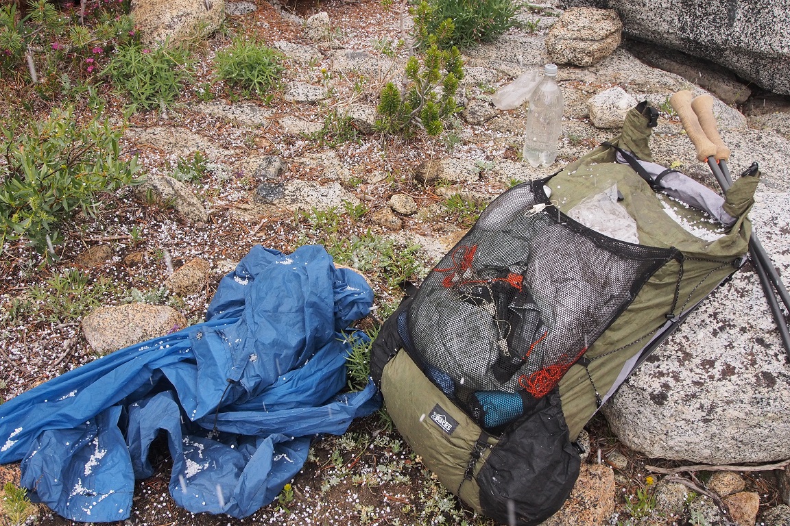
It hailed and thundered in the early morning hours. I could see in the dim light that my trenches and berms were doing the job. My neighbor’s tent would likely be sitting in a big puddle in the morning, which gave me a shameful sense of schadenfreude. I woke up around 6am to ground scattered with white pellets.
I made my coffee and had my Snickers bar, and walked the meadow, listening to the sounds, wondering when I’d be back here. Also about these moments that I spent alone; shared with no one, and what it meant, before packing my stuff and heading off down the trail.
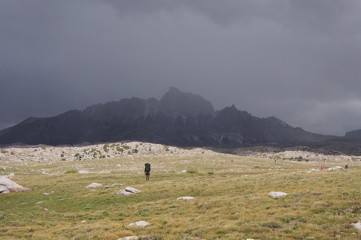
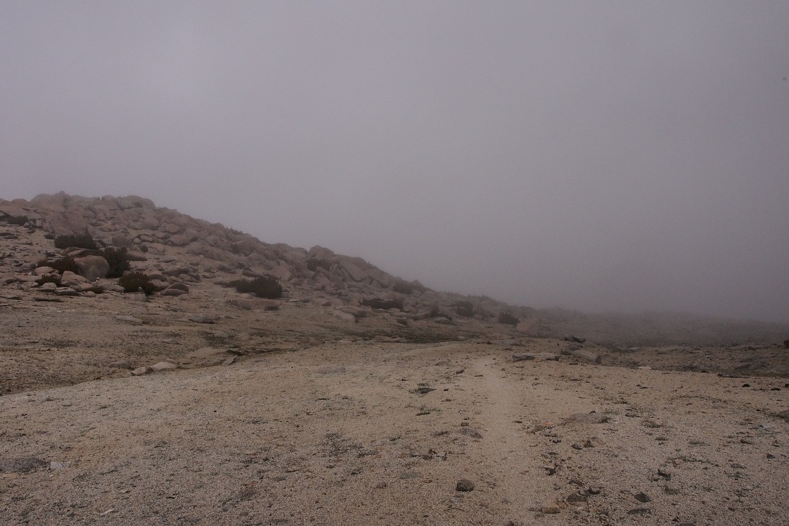
One other matter needed to be taken care off; the camp was so crowded, it was difficult to find a place with enough privacy to pee, let alone squat. I hoped to find something not too far down the trail, before it got busy. I spotted a place up the slope and not likely to have any one stumble passed and did my business. I made quick work of the ascent to where the use trail to Darwin Bench meets the JMT. The clouds sat low on Mt Mendel above me and I wondered if they would lift at all this day. I was going there for the view, and it looked like there might not be one. Prior days had started sunny and clear before the passing into afternoon storms and then clearing again in the evening. It didn’t bode well that the rain started so early today. I thought about going to Evolution Lake and spending the night there, before trying Darwin Bench tomorrow. But I assumed it would end up as crowded as McClure Meadow, so started climbing to the bench.
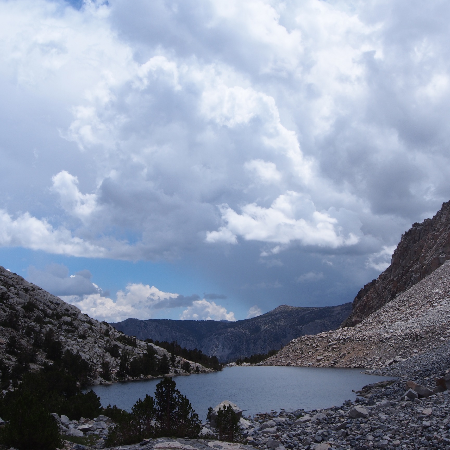
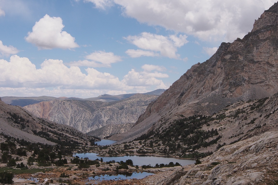
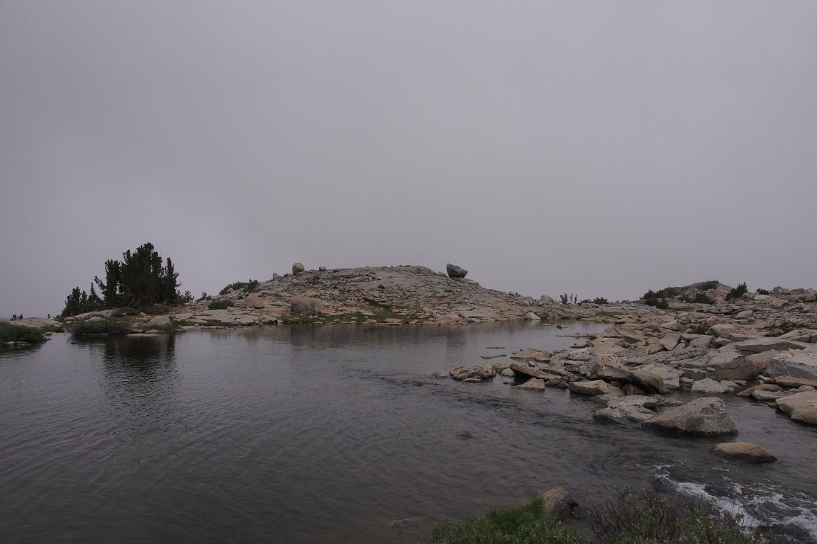
The low clouds promised little but a moody atmosphere. I stepped onto the bench near the first tarn around 9:30am and could just barely see the other side of the nameless lake.
I tried to recall exactly where I camped last time. I wanted to get the better spot on top of the granite rise this time. I started making my way around the lake when I ran into a family heading the other direction; rather, I waved them over to me. They looked to be headed in the wrong direction to find the trail down to the JMT, and I assumed (correctly) that this is what they were looking for. It was a husband, wife and two kids, between 8-10, I’d guess, and they had come over Lamarck Col yesterday from Lamarck Lakes and spent the night in Darwin Canyon. They were thinking of getting to Evolution Lake today, and then reversing out the next. I showed them where the trail started, and asked about the weather. They said they got pelted with hail most of the night, but didn’t have any more of an updated forecast than I did. We went on our way. I had camped near that first tarn, on the other side of the creek, but I didn’t see a way across, so, doubting my memory, I figured it must have been somewhere else. But as I looked back part way across the lake, I could see the granite hump and the group of trees, so I turned back.
Now that I was oriented,I found the spot where I’d rock hopped across the small outlet creek, but it was running deep and fast. I recalled that last time I had been here it was late September, not early July, and the water had certainly been lower. Now the rocks, underwater, would be too slick, and the water knee deep and fast. I could go further onto the bench, find a crossing and then double back. The weather was clearly about to turn.
My amateur forecasting proved correct as it started to rain, and then hail, and I evaluated my situation; if I couldn’t get to my desired site with dry feet, and there would be no view, did I really wanted to spend the day here, hours laying under my tarp? The temps were in the mid 40s and I was getting cold standing still. Why was I out here? I refilled my water and mixed more Perpetuem, then decided to try and hike out.
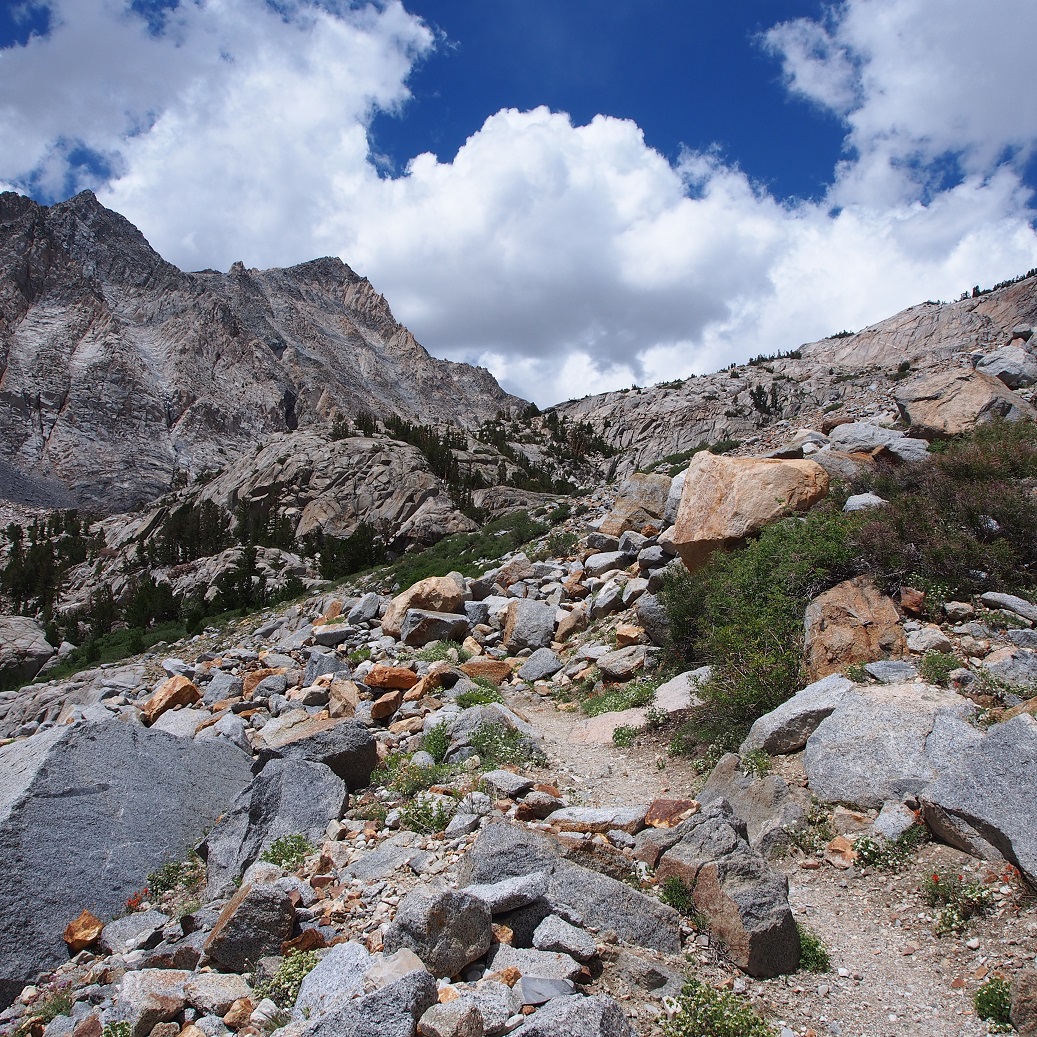
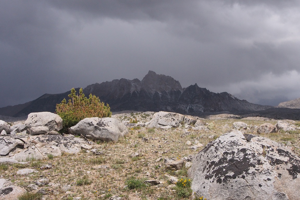
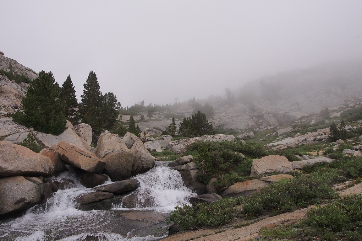
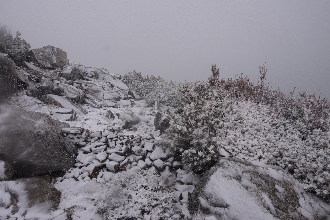
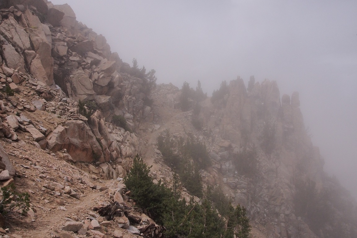
The bench was beautiful, even with the surrounding peaks hidden in cloud, making navigation difficult, with fewer landmarks to sight on.
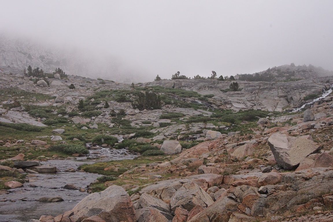
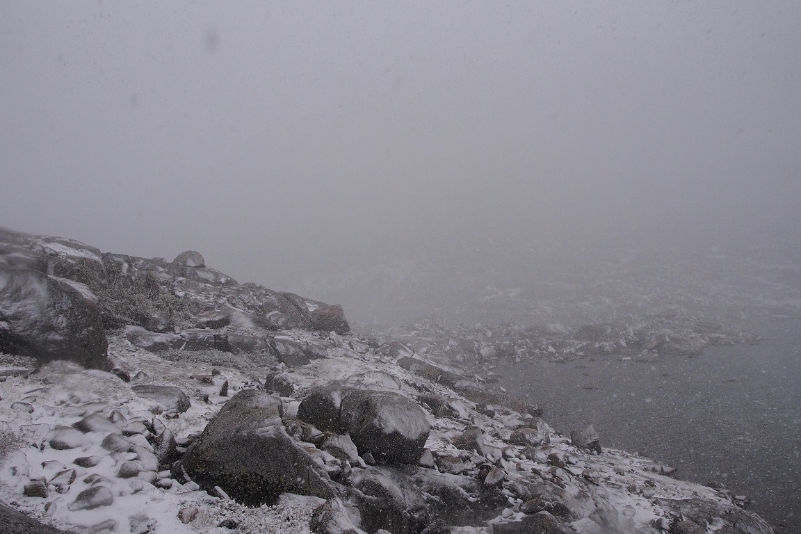
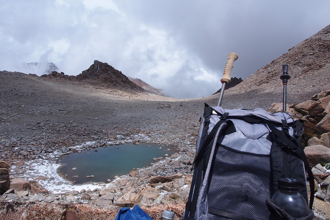
I knew that I followed this creek up a series of ledges to Lake 1 in Darwin Canyon. The use trail faded in and out. As I climbed higher, the hail turned to snow and the visibility dropped to tens of yards. I started to get a little nervous, but I told myself I couldn’t get lost because I knew where I came from, and I could turn around at any point and spend the night, as I had originally planned, without anyone worrying where I was. There was no rush.
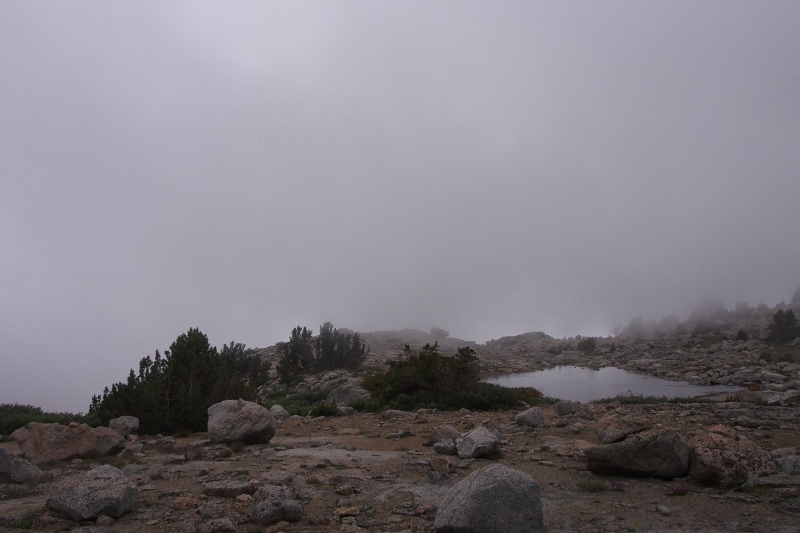
I found what had to be Lake 1, but without being to see much more than 10 yards out, I couldn’t be absolutely sure.
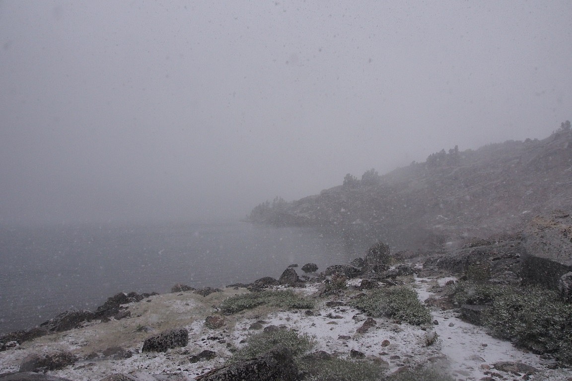
What if I had followed the wrong creek and wandered up toward Alpine Col? The only way to be sure was to walk on. The snow collected on the ground, and my hat. The trail was sometimes visible, sometimes not on the rocky shore. I was getting to experience route-finding on my own, rather than following someone else’s track. I came to Lake 2, relieved that I was on the correct track.
My hands were cold, but I didn’t want to put on my thin gloves unless I really had to, since much of the way was climbing hand over hand, finding safe footing and grip on snow covered slabs of tumbled granite. If I turned around and spent the night, I wanted dry gloves to put on my hands. My pants were wet as well, from sitting and scooting across the inconveniently angled granite, searching for safe purchase. My rain poncho kept my top half dry and I knew the pants would dry quickly once I got out of the precipitation.
I made a mantra of slow and steady, I couldn’t risk a fall here, reminding myself there was no hurry, it was still quite early to either go ahead or turn back. .
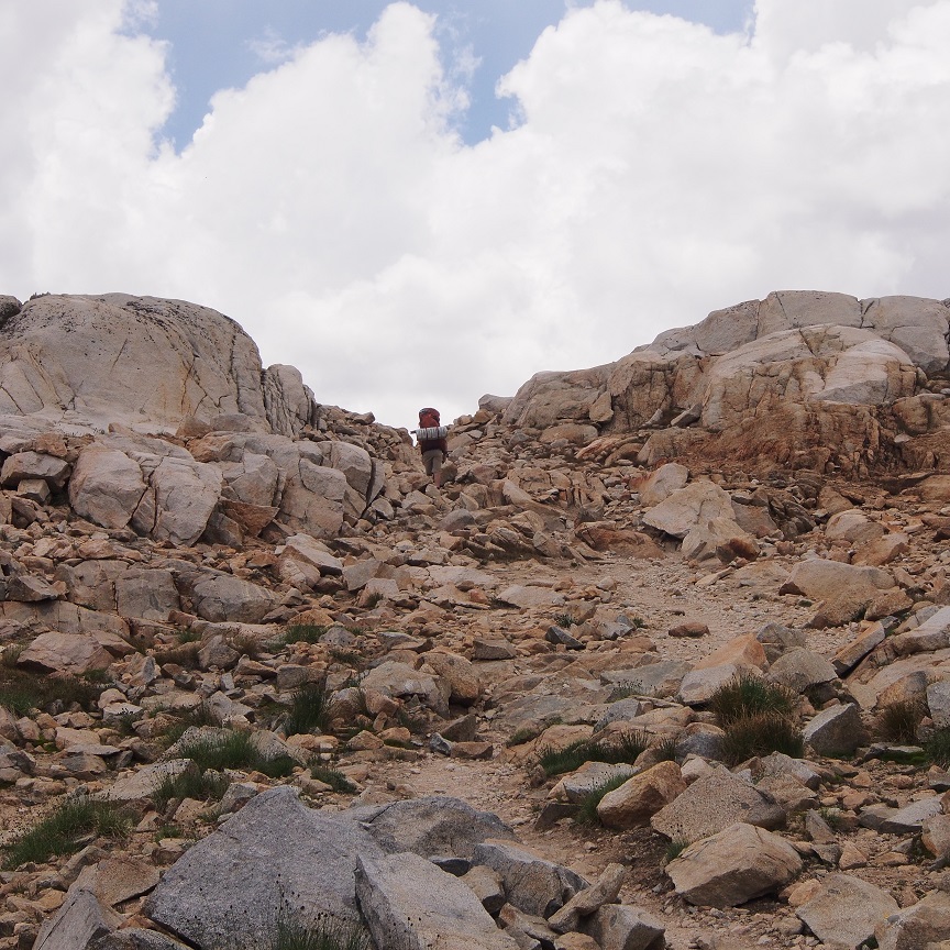
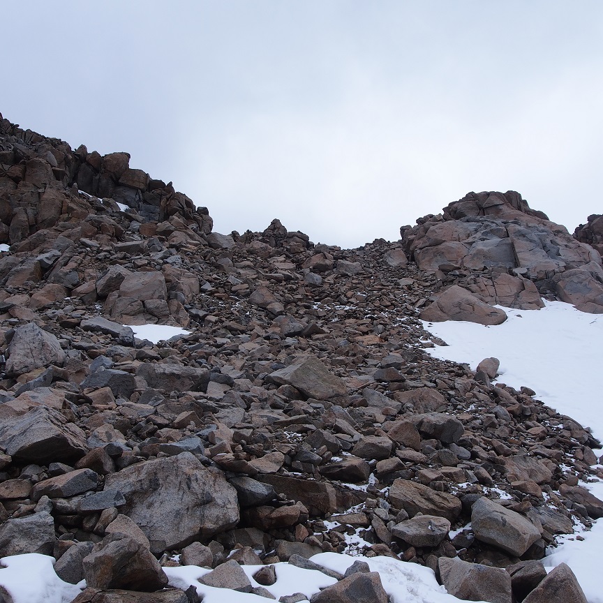
There is, though, that point you can reach, where the investment you’ve made in going forward makes it difficult to throw it away by turning back, even if that route makes the most sense. Every few minutes, or seconds, time didn’t matter right now, I tried to evaluate whether I was going on because it was fine to go on, or because I had mentally reached that ‘No turning back’ point. There were several times when the way disappeared into those tumbled fields of granite that I almost did turn back, when there didn’t seem any good way through. It would have been difficult enough to do in dry weather, let alone when covered with inches of wet snow. If I was cold anymore I didn’t notice it. My head got heavy as the snow collected on the brim of my hat. There are only a few pictures because I kept my all my focus on moving safely. Fear and suffering focus the mind like a form of meditation.
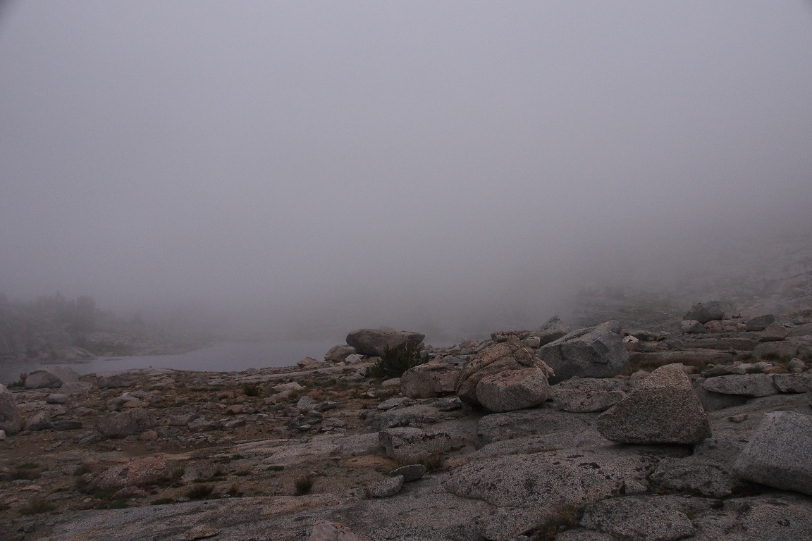
I passed along Lake 3 quickly and came to Lake 4.
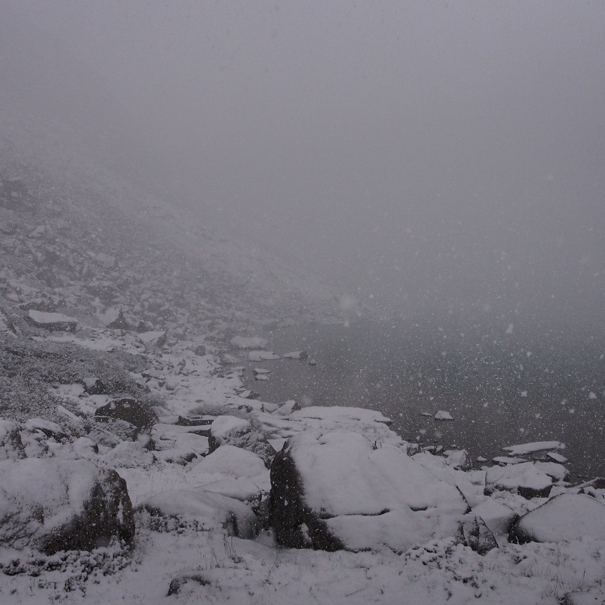
It was time to figure out where to ascend to the Col. Richard’s instructions in Backpacking California say to go near to the end before angling up northeast. Last time I undershot. I knew the Col was a notch along that jagged ridge, but there were a few of those from which to choose.
I angled up. The climbing went quickly.. I was confident in my choices, looking back and forth at the map and lakes 4 and 5 below me to orient myself. Every step was measured and tested, even going quickly. I used my poles to check for gaps hidden in the snow covered brush. I saw further up a chute that I thought I remembered ascending last time, that took me to the left of the Col, off target, so this time I went right. I looked back down at the lakes, and judged myself to be getting too far south, mostly from having picked the path of least resistance, so I headed back northeast. After a few false summits, I knew I was getting near the real one, but I still couldn’t pick out the little National Park Service sign identifying the Col on the jagged ridgeline. I was pretty sure I’d correctly identified Lamarck Mountain and the pointy peak just south of Col. I stood just below it and looked around. I saw what had to be a use path, and my eyes followed it up to the sign. I’d gone too far south again in my last bit of climbing, but I wasn’t more than 50 yards away. It was frustrating, because the direct way looked difficult, and it might be easier to descend a bit and then climb. I decided on the direct way. I told myself again that I was just about there, it was only 1pm, to watch and measure every step. My third step didn’t find rock, just open space, and I fell forward, dropping a few feet, catching myself on a slab in front of me, angled at a fortuitous 60 degrees, banging my knees pretty good, but otherwise okay. Oh, and I broke a trekking pole, pinning it between myself and the rock. Lamarck Col was becoming my nemesis.
I made it to the Col shaken but without any further incident. I replayed the fall in my head over and again and couldn’t figure out how I’d missed the step. I was just lucky not to turn or twist an ankle or knee or worse, thinking about that rescue drop I’d seen in Hutchinson Meadow two days before. Helicopter rides were expensive.
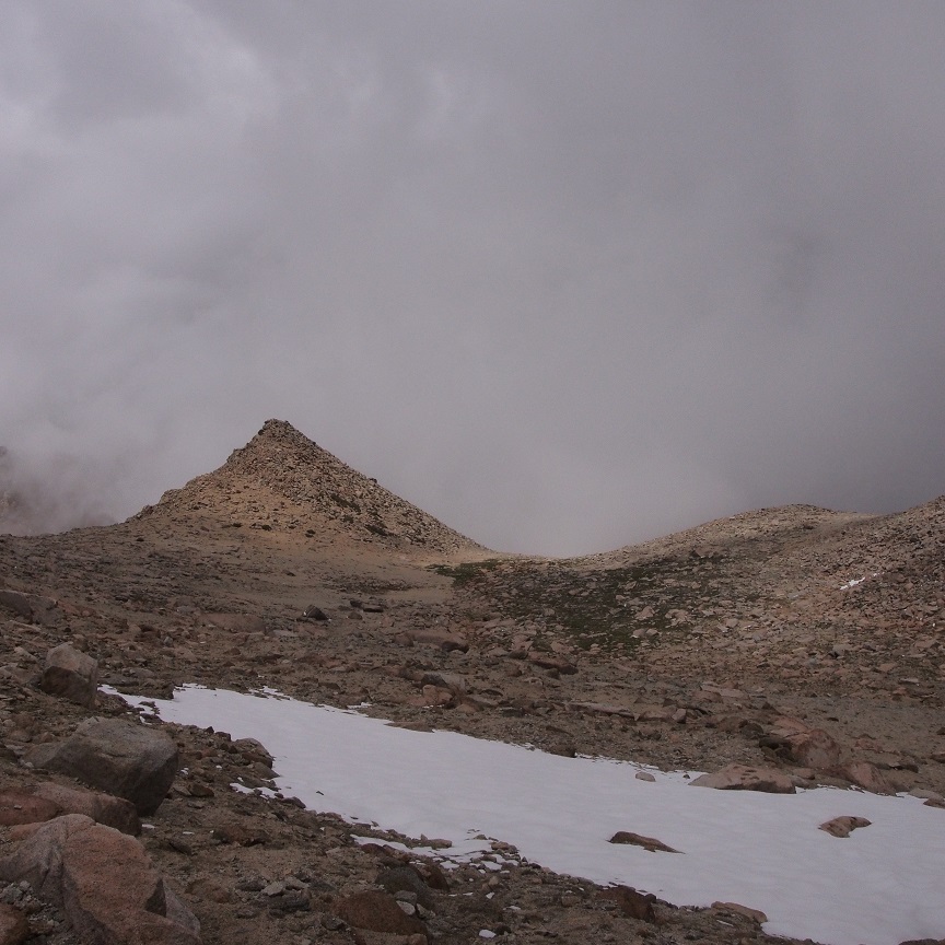
I didn’t even notice that the snow had stopped and the skies around me had cleared.
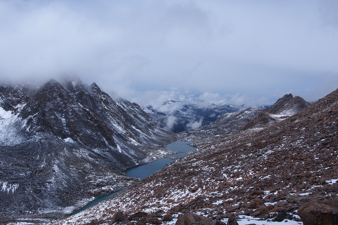
I took a picture and started down.
This was the home stretch, all downhill from here.
That was how I felt last time too; then I got lost. I picked my way around the tarn and down the broad sandy basin.
I started to get butterflies in my stomach as I approached the spot where I made the wrong turn last time, when I had followed what looked like a use trail until I was scrambling over boulders, persisting for maybe twenty minutes too long before accepting that I had going the wrong way. The terrain and map at that point looked like I could have made a difficult scramble down to Grass Lake, but I couldn’t tell if there was a spot where the terrain would become impassible, I climbed back to the start and tried the other side before quickly understanding that was also not the correct way. I sat down, frustrated, and a little panicked. i had never been lost before. I studied the map and it’s contours, talked myself down from my panic, before getting up and following the use trail one more time, and saw, faintly where it turned off along the correct route.
This time, it didn’t take me quite so long. I didn’t find the trail right away, but I knew the direction I was supposed to go, so I went, and I spotted it after one hundred yards or so. From there, it was just one foot in front of the other..
Clouds moved in and out, sometimes masking the trail in a way that made me think of Chinese landscape paintings I ponder on Friday nights at The Met back in Manhattan.
I passed Lower Lamarck Lake and considered stopping and setting up camp. But my mind had already transitioned to a hotel room. I’m not sure how people do the Pacific Crest or even the John Muir trail; a few nights out is good enough for me.
I regretted a bit not staying on Darwin Bench. It might have been cold and wet and boring, but maybe I should’ve challenged myself to do it. On the other hand, I had challenged myself in another way; finding my way cross-country in a July snowstorm. Anyway, the decision had been made and was done.
I managed to not get off track and got back to the trailhead at about 5pm. As I suspected, the trail junction I missed was right there where all the people had been standing three days ago. I wondered if it had snowed in Humphreys Basin, where if things had gone according to the original plan, I would’ve been spending that night.
The car was unharmed, and I stripped off my pack and put on sandals for the drive back. I kept glancing at the peaks in the rear view mirror, still cloaked in cloud; maybe snowing again? Or hailing?
I came to Lamarck Col a second time, partly to have a do over, party for this view,
which I never got to see. I’ll probably be back here again. I want to go back to Darwin Bench. I want to see Dusy Basin again and McClure Meadow. Maybe next time I’ll go to French Canyon or over Alpine Col instead. And I’d like to take at least one trip here that doesn’t end with me breaking a trekking pole.